
Denver Art Museum
The Denver Art Museum is an art museum in Denver, Colorado located in Denver's Civic Center. It is known for its collection of American Indian art, and has a comprehensive collection numbering more than 68,000 works from across the world.
Contents
[hide]- 1 History of the museum
- 2 Architecture
- 3 Collections
- 4 Education
- 5 Funding
- 6 References
- 7 External links
[edit]History of the museum
The museum's origins can be traced back to the founding of the Denver Artists Club in 1893. William C. and Kenton Forest. Denver: A pictorial history from frontier camp to Queen City of the Plains. Colorado Railroad Museum, 1993. In 1916, the Club renamed itself the Denver Art Association. Two years later in 1918, the Denver Art Association became the Denver Art Museum and opened its first galleries in the City and County building. Later, in 1922 the museum opened galleries in the Chappell House. The house, located on Logan Street, was donated to the museum by Mrs. George Cranmer and Delos Chappell. In 1948, the DAM purchased a building on Acoma and 14th St. on the south side of Civic Center Park. Harris, Neil. "Searching for Form." The First Hundred Years. The Denver Art Museum, 1996, Denver architect Burnham Hoyt renovated the building which became known as the Schleier Gallery. While the Schleier Gallery was a significant addition, the DAM still sought to increase its space. Additional pressure came from the Kress Foundation who offered to donate three collections valued at over $2 million on the condition that DAM construct a new building to house the works. Harris, Neil. "Searching for Form." The First Hundred Years. The Denver Art Museum, 1996, DAM sought help from the city and county of Denver to raise funds. However in 1952 voters failed to approve a resolution bond. Despite this setback, the museum continued to raise funds and eventually opened up a new building. This new building, called the South Wing, opened in 1954 and made it possible for DAM to receive the Kress Foundation's gifts. A major addition opened on October 3, 1971. Jones, William C. and Kenton Forest. Denver: A pictorial history from frontier camp to Queen City of the Plains. Colorado Railroad Museum, 1993, The addition, now called the North Building, was designed by Gio Ponti and local architect James Sudler. The architecturally unique building stands 7 stories tall, has 24 sides, and is clad in grey glass tiles specially designed by Dow Corning.
- 2006 February: The Duncan Pavilion is a 5,700 SF second storey addition to the Morgan Wing that came to receive the bridge traffic from the new Frederic C. Hamilton and the existing 1971 North Building once the renovation is completed. The Duncan Pavilion is designed as a temporary structure intended not to compete architecturally with the existing historical buildings or the new Frederic C. Hamilton building. It provides a large attrium space for a rest half way through museum tours and roof deck where one can see sweeping vistas of the city and stand directly under the prow of the Hamilton. Along with the addition the project renovated the mechanical system and visitor circulation in the Morgan Wing.
Frederic C. Hamilton Building, Under Construction
- 2006 October: The completion and opening date of a major expansion, the Frederic C. Hamilton building, designed as a joint venture by Studio Daniel Libeskind and Denver firm Davis Partnership Architects(architect of record). The new building opened on October 7, 2006, and is clad in titanium and glass. The project was recognised by the American Institute of Architects as a successfulBuilding Information Modeling project [1].
History of the museum The museum's origins can be traced back to the founding of the Denver Artists Club in 1893.Jones, William C. and Kenton Forest. Denver: A pictorial history from frontier camp to Queen City of the Plains. Colorado Railroad Museum, 1993. In 1916, the Club renamed itself the Denver Art Association. Two years later in 1918, the Denver Art Association became the Denver Art Museum and opened its first galleries in the City and County building. Later, in 1922 the museum opened galleries in the Chappell House. The house, located on Logan Street, was donated to the museum by Mrs. George Cranmer and Delos Chappell. In 1948, the DAM purchased a building on Acoma and 14th St. on the south side of Civic Center Park. Harris, Neil. "Searching for Form." The First Hundred Years. The Denver Art Museum, 1996, Denver architect Burnham Hoyt renovated the building which became known as the Schleier Gallery. While the Schleier Gallery was a significant addition, the DAM still sought to increase its space. Additional pressure came from the Kress Foundation who offered to donate three collections valued at over $2 million on the condition that DAM construct a new building to house the works. Neil. "Searching for Form." The First Hundred Years. The Denver Art Museum, 1996, DAM sought help from the city and county of Denver to raise funds. However in 1952 voters failed to approve a resolution bond. Despite this setback, the museum continued to raise funds and eventually opened up a new building. This new building, called the South Wing, opened in 1954 and made it possible for DAM to receive the Kress Foundation's gifts.
A major addition opened on October 3, 1971. William C. and Kenton Forest. Denver: A pictorial history from frontier camp to Queen City of the Plains. Colorado Railroad Museum, 1993, The addition, now called the North Building, was designed by Gio Ponti and local architect James Sudler. The architecturally unique building stands 7 stories tall, has 24 sides, and is clad in grey glass tiles specially designed by Dow Corning.
[edit]Architecture
Architect Daniel Libeskind, who is seen here on the Frederic C. Hamilton Building section of the museum, was the designer behind the building.
The newest edition to the Denver Art Museum is the Frederic C. Hamilton Building which holds the Modern and Contemporary Art collection along with the Architecture and Design and Oceanic Art collections. The unique building will also serve as the main entrance to the rest of the museum complex.[1] This ambitious design doubled the size of the museum allowing for an even greater expansion of the art inside of the daring aesthetic exterior.
The complex geometrical design of the Frederic C. Hamilton building consists of 230,000 square feet of titanium shingles that cover the 20 sloping planes of the structure. The angles jut in all directions and the 2,740-ton structure contains more than 3,100 pieces of steel. One of the angles extends 100 feet over the road running below. Of all the 20 planes, not one is parallel or perpendicular to another.[2]
Because of the distinct configuration of the steel to produce the very bold building, the Frederick C. Hamilton extension of the DAM received a Presidential Award of Excellence from the American Institute of Steel Construction’s 2007 Innovative Design in Engineering and Architecture with Structural Steel (IDEAS2) awards program. In the determination of winning projects, the AISC’s judges considered each project’s use of structural steel from both an architectural and structural engineering perspective with emphases on “creative solutions to the project’s program requirements; applications of innovative design approaches in areas such as connections, gravity systems, lateral load resisting systems, fire protection, and blast; the aesthetic and visual impact of the project, particularly in the coordination of structural steel elements with other materials; the innovative uses of architecturally exposed structural steel and advances in the use of structural steel, either technically or in the architectural expression.” [3]
The design had so many extended angular planes to be reminiscent of the landscape. Similar to the peaked roof of the Denver International Airport symbolizing the snowcapped Rocky Mountains, the Denver Art Museum’s Frederic C. Hamilton building is meant to emulate the unique, sharp angles the nearby Rockies hold as well as the geometric crystals found at the base of the mountains close to Denver. Architect of the intricate structure, Daniel Libeskind said, “I was inspired by the light and geology of the Rockies, but most of all by the wide-open faces of the people of Denver” [4] Because of the steel construction covered in 9,000 titanium panels, the building also reflects the soft and strong light of the Colorado sunshine. The architect of the original North Building, Gio Ponti, said that “Art is a treasure, and these thin but jealous walls defend it.” Ponti wanted the DAM building, housing the important art within, to break from the traditional museum archetypes by placing more than a million reflective glass tiles on the building’s exterior along with a dramatic “castle-like” façade.[5]
While the majority of the artwork is within the buildings, there are also significant works of outdoor sculptures. Libeskind also designed a landscaped pedestrian plaza to go along with the Denver Art Museum complex as a whole. These outdoor sculptures include 'Scottish Angus Cow and Calf' by Dan Ostermiller, the 'Big Sweep' by Coosje van Bruggen and Claes Oldenburg and an untitled work by Beverly Pepper.[6] On the entire design, Libeskind commented, “The project is not designed as a standalone building but as part of a composition of public spaces, monuments and gateways in this developing part of the city, contributing to the synergy amongst neighbors large and intimate.”
With such a dramatic design for a museum, the building has received mixed reviews. The architecture critic for The Los Angeles Times, Christopher Hawthorne, says that museum architecture does not always blend cohesively with a great architectural achievement. Hawthorne reported that “It’s a really stunning piece of architectural sculpture, but the aggressive forms make it a pretty terrible place for showing and looking at art.” [7] The director of the Denver Art Museum, Lewis Sharp, says that one of the most thrilling moments about the building is how the visitors are brought in to seeing the artwork within in an entirely new, exciting environment as the artists’ work is displayed and hung in over 20 different ways on the dramatic, sloping, obliquely shaped galleries. Sharp states, “I think you often see things that you had never seen before. It just raises all types of potentially new ways to engage a visitor.” [8] And many visitors and Denver residents love it as Emily and David Andreeson say, “We’re in normal looking buildings every single day. It’s just kind of an experience to walk into a room that doesn’t look like rooms that we would normally be in.” And that is exactly what the museum was looking for as their expansion, Sharp says. He stated that the museum’s board was seeking the opportunity to draw people to the wonderful city by building something radical and spectacular to capture the attention of people around the country and the world.</ref> In any case, the Frederic C. Hamilton building is certainly a standout among the city-scape of Denver in many ways.
[edit]Collections
The museum has nine curatorial departments: architecture, design & graphics; Asian art; modern and contemporary; native arts (American Indian, Oceanic, and African); New World (pre-Columbian and Spanish Colonial); painting and sculpture (European and American); photography; Western art; and textile art.
[edit]Architecture, design and graphics
Formed in 1990, the department opened its first permanent galleries in 1993. Changing exhibitions drawn from its collection of fine and decorative arts are displayed on the sixth floor, featuring pre-1900 European and American decorative arts. 20th-century design galleries are located on the second floor.
[edit]Asian art
The museum's Asian art collection, the only such resource in the Rocky Mountain region, includes four main galleries devoted to the arts of India, China, Japan and Southwest Asia. Additional galleries offer works from Tibet, Nepal and Southeast Asia, while thematic galleries display religious art and traditional folk crafts.
[edit]Modern and contemporary
The modern and contemporary collection of 20th-century art contains over 4,500 works with an emphasis on both internationally known and emerging artists. The department also includes the Herbert Bayer collection and archive, an important Bauhaus artistic and scholarly resource, containing some 2,500 items including works by artists such as Man Ray, Andy Warhol, David Hockney, Robert Motherwell, Damien Hirst, Philip Guston, Knox Martin, Dan Flavin, John DeAndrea, Gottfried Helnwein and Yue Minjun.
[edit]Linda
One of the museum's most popular and frequently asked-about pieces[citation needed] is part of the modern and contemporary collection. Linda, by Denver artist John DeAndrea, is a life-size realistic sculpture of a sleeping woman. Made of polyvinyl, this piece is sunlight-sensitive and is therefore shown only for short periods of time. The museum also owns another piece by the same artist, Clothed Artist and Model (1976).
[edit]The Shootout
In 1983 the museum became the home of Red Grooms' controversial pop-art sculpture The Shootout, which portrays a cowboy and an Indian shooting at one another. The sculpture, now on the roof of the museum restaurant, had been evicted from two other downtown Denver locations after Native-American activists protested and threatened to deface the work.[9]
[edit]Native arts
[edit]Native American
The museum's collection of American Indian art has over 16,000 works representing over a hundred tribes across North America. Under the direction of Arnold Ronnebeck, Art Director from 1926–1930, the Denver Art Museum was one of the first museums to use aesthetic quality as the criteria to develop such a collection, and the first art museum in this country to collect American Indian arts. The museum exhibits these items as art rather than anthropological artifacts. The range of Native American art styles is reflected in such diverse objects as Northwest Coast woodcarving, Naskapi painted leather garments, Winnebago twined weaving, Plains Indian beadwork, Navajo weaving, Pueblo pottery, and California basketry.
[edit]Oceanic
The Oceanic collection, on view in the Hamilton Building, includes all major island groups, with particular strength in late 18th and early 19th century wood carving and painted bark cloth from the islands of Samoa, Tonga and Hawaii. The Melanesian collection consists of masterpieces from Papua New Guinea and New Ireland. The contemporary Oceanic works, including paintings, drawings and prints, add distinction to the collection and demonstrate cultural continuities and innovation in Oceanic artistic traditions.
[edit]African
The African collection consists of approximately 1,000 objects, and focuses on the diverse artistic traditions of Africa, including rare works in sculpture, textiles, jewelry, painting, printmaking and drawings. Although the strength of the collection is west African art, with emphasis on Yoruba works, there are masterpieces from all regions and mediums of expression including wood, metals, fibers, terracotta and mixed media compositions. The hallmark of the collection includes contemporary expressions, comprising paintings, sculptures, drawings, videos and prints from prominent living artists with international reputations. Interactive elements in the gallery include an iPod station with African music selections, an area where you can create rubbings using African designs and a movie hide-away for the kids.
[edit]New World (pre-Columbian and Spanish Colonial)
The museum has a comprehensive representation of the major stylistic movements from all the geographic areas and cultures of Latin America. The New World Collection, comprising over 5,500 objects, is exhibited in a unified presentation of the arts of Latin America. Included are pre-Columbian masterworks of ceramic, stone, gold and jade, as well as paintings, sculpture, furniture and silver from the Spanish Colonial Period.
The Frederick & Jan Mayer Center at the Denver Art Museum [2] is dedicated to increasing awareness and promoting scholarship in the fields of Pre-Columbian and Spanish Colonial art through the New World collections of the Denver Art Museum. To this end, the Mayer Center sponsors annual symposia and publication of their proceedings, the publication of additional volumes as it sees fit, research opportunities including a resident fellowship program and periodic study tours to Latin America and Spain. The programming of the Mayer Center is developed and administered by the staff of the New World Department, Denver Art Museum.
[edit]Pre-Columbian
The Denver Art Museum Pre-Columbian Collection is encyclopedic in breath and depth, and exhibited in an open storage gallery, allowing scholars to view the entire collection. The Pre-Columbian collection represents nearly every major culture in Mesoamerica, lower Central America, and South America. The collection’s greatest strength is the Mayer Central American collection which includes gold, jade, stone and earthenware from Costa Rica, Nicaragua and Panama. Mayan art from Mexico, Guatemala and Belize is especially significant and contains a large number of very important works. Other significant holdings from Mesoamerica include our West Mexican, Teotihuacan and Olmec collections. South American collections are especially strong in Ecuadorian and Colombian art and in several of the Peruvian styles, particularly Moche, Wari, Tiwanaku and Chimu.
[edit]Spanish Colonial
The museum collection of Spanish Colonial painting and furniture is especially strong in Mexican painting, largely due to the collecting interests and generosity of the Mayer family. Another area of great strength is Peruvian Colonial paintings from the Frank Barrows FreyerCollection. Silver holdings, comprising the Appleman and Stapleton collections, and furniture holdings from all over Latin America represent a comprehensive collection. The Anne Evans collection of Spanish Colonial art from the southwestern United States is yet another significant strength of the collection.
[edit]Painting and sculpture (European and American)
The over 3,000 objects in this department is composed of American and European painting, sculpture, and prints through the early 20th century. The European collection is richest in Renaissance and 19th-century French paintings. The American collection consists of paintings, sculpture, prints, and drawings representing all major periods in American art before 1945. Artists represented include Sandro Botticelli, Defendente Ferrari, Camille Pissarro, Claude Monet, Henri Matisse, Pablo Picasso, and Georgia O'Keeffe. Other painters represented include;Jacopo del Casentino ("Madonna and Child"), Bernardo Zenale, Niccolò di Pietro Gerini ("4 Crowned Saints Before Diocletan"), Filippino Lippi, William-Adolphe Bouguereau, Berthe Morisot, Max Beckmann, Juan Gris,and Georges Braque.
[edit]The Berger Collection
Works are also on view from The Berger Collection, one of the largest private individual collections of British art in the world, with more than 150 pieces by British artists such as Thomas Gainsborough, Edward Lear and other artists of the English School that covers a period of 6 centuries.
[edit]Photography
Photography—previously incorporated in the modern and contemporary and Western collections—became a separate department in 2008.
[edit]Textile art
The collection ranges from Coptic and pre-Columbian textiles to contemporary works of art in fiber, overlapping culturally and chronologically with all but the Native Arts Department. A nationally-recognized collection of American quilts and coverlets, the Julia Wolf Glasser Collection of samplers, and the Charlotte Hill Grant Collection of Chinese Court Costumes are among the strengths of the department.
[edit]Western
The Petrie Institute of Western American Art at the Denver Art Museum was established in 2001. Also that year, the collection was augmented by the Harmsen Foundation's donation of over 700 paintings. The Harmsen Collection joined a collection already rich in 19th-century photographs of the West and with such masterworks as Charles Marion Russell's In the Enemy's Country, Frederic Remington's The Cheyenne, and Charles Deas’s Long Jakes.
[edit]The Harmsen Collection
The Harmsen Collection contains works by artists and photographers who charted the colonization of the American West in the late 19th and early 20th centuries, such as Frederic Remington, Charles M Russell, Frank E. Schoonover, and Frank Tenney Johnson as well as more modern interpreters of American & Western art, such as Gerald Curtis Delano, Harvey Dunn, Dan Muller and Raymond Jonson.
[edit]Selected past exhibitions
- 1999 Impressionism: Paintings Collected by European Museums, which received 215,000 visits.
- 2000 Matisse from The Baltimore Museum of Art which received 155,000 visits.
- 2001 European Masterpieces: Six Centuries of Paintings from the National Gallery of Victoria, Australia
- 2002 The Cos Cob Art Colony: Impressionists on the Connecticut Shore
- 2002 Metamorphosis: Modernist Photographs by Herbert Bayer and Man Ray
- 2002 US Design 1975-2000
- 2002 Art & Home: Dutch Interiors in the Age of Rembrandt
- 2003 Antarctica: Through the Eyes of Those Who Live It
- 2003 Bonnard
- 2003 Sargent and Italy
- 2003 El Greco to Picasso from The Phillips Collection, which received 191,000 visits
- 2003 RETROSPECTACLE: 25 Years of Collecting Modern and Contemporary Art
- 2004 Frederic Remington: The Color of Night
- 2004 Painting a New World: Mexican Art and Life, 1521-1821
- 2004 Tiwanaku: Ancestors of the Inca
- 2005 Heaven and Home: Chinese Art of the Han Dynasty from the Sze Hong Collection
- 2005 Amish Quilts: Kaleidoscope of Color from the Collection of Faith and Stephen Brown
- 2005 Blanket Statements, an exhibition of Navajo Weavers
- 2005 New Classics, contemporary pieces from the Museum’s American Indian collection, by a variety of artists including Dan Namingha, Emmi Whitehorse, Mateo Romero and Kevin Red Star.
- 2006 RADAR: Selections from the Colorado Collection of Vicki and Kent Logan
- 2006 Breaking the Mold: The Virginia Vogel Mattern Collection of Contemporary Native American Art
- 2006 Japanese Art From the Collection of John and Kimiko Powers
- 2007 Artisans & Kings: Selected Treasures from the Louvre
- 2007 Color as Field: American Painting, 1950-1975
- 2007 Maria: American Icon
- 2007 George Carlson: Heart of the West
- 2007 Clyfford Still Unveiled: Selections from the Estate
- 2008 Inspiring Impressionism
- 2008 Landscapes from the Age of Impressionism
- 2009 The Psychedelic Experience: Rock Posters from the San Francisco Bay Area, 1965-71
[edit]Education
The museum’s Education Department has emphasized three areas: research in making museum visits successful and enjoyable, the creation of innovative installed learning materials (e.g., audio tours, labeling, video and reading areas, response journals, and hands-on and art-making areas), and interactive learning for young people both in school and family groups. Family-friendly programs such as the Just for Fun Family Center, Eye Spy gallery games, the Discovery Library, Kids Corner, and Family Backpacks have been both popular and successful. In particular, the Family Backpack program has been adopted and adapted by other institutions, ranging from the Victoria and Albert Museum to the Henry Ford Museum.
[edit]Funding
The museum is run by a non-profit organization separate from the City of Denver. Major funding for the museum is provided by a 0.1% sales tax levied in the Scientific and Cultural Facilities District (SCFD), which includes seven Colorado counties in the Denver-Aurora metropolitan area. About 60% of this tax is used to provide funding for the Denver Art Museum and three other major science and cultural facilities in Denver (the Denver Botanic Gardens, the Denver Zoo, and the Denver Museum of Nature and Science). In addition, the museum receives large private donations and loans from private collections. Over the past five years, the Denver Art Museum has averaged 465,000 visitors a year. Total revenues for the Museum in 2003 were $23 million.
New York City Streets
Southern California
Southern California (SoCal) is a megaregion, or megapolitan area, in the southern area of the U.S. state of California. Large urban areas include Greater Los Angeles and Greater San Diego. The urban area stretches along the coast from Ventura through the Southland and Inland Empire to San Diego. The United States - Mexico border makes up the southern border. Southern California is a major economic center for the state of California and the nation.
Southern California's population encompasses five metropolitan, or MSA, areas: Los Angeles County and Orange County together make up the Los Angeles metropolitan area; the Inland Empire consists of such cities asRiverside, Ontario, and San Bernardino; the San Diego metropolitan area; the Oxnard-Thousand Oaks-Ventura metro area; and the El Centro area. Out of these, three are heavy populated areas; the Los Angeles area with over 12 million inhabitants, the Riverside-San Bernardino area with over 4 million inhabitants, and the San Diego area with over 3 million inhabitants. For CSA metropolitan purposes, the five counties of Los Angeles, Orange, Riverside, San Bernardino, and Ventura are all combined to make up the Los Angeles metropolitan area; with San Diego as Southern California's other CSA metropolitan area. With over 22 million people, roughly 60% of California's population resides in Southern California.
To the east of Southern California are the Colorado Desert and the Colorado River at the border with the state of Arizona, and the Mojave Desert at the border with the state of Nevada. To the south lies the international border with Mexico, and to the west lies the Pacific Ocean. With combined surface area of 56,512 sq mi, Southern California alone is bigger than England.
Contents
[hide][edit]Significance
San Diego Marina districtSunset in
Venice, a district in Los Angeles
Within Southern California are two major cities, Los Angeles and San Diego, as well as three of the country's largest metropolitan areas.[1] With a population of 3,792,621, Los Angeles is the most populous city in California and the second most populous in the United States. Just to the south and with a population of 1,307,402 is San Diego, the second most populous city in the state and the eighth most populous in the nation.
Its counties of Los Angeles, Orange, San Diego, San Bernardino, and Riverside are in the top 15 most populous counties in the United States and all five are the top 5 most populous counties in California.[2] The region is also home to Los Angeles International Airport, the second-busiest airport in the United States by passenger volume (see World's busiest airports by passenger traffic) and the third by international passenger volume (see Busiest airports in the United States by international passenger traffic); San Diego International Airport the busiest single runway airport in the world; Van Nuys Airport, the world's busiest general aviation airport; major commercial airports at Orange County, Ontario, Burbank and Long Beach; and numerous smaller commercial and general aviation airports. Southern California is also home to the Port of Los Angeles, the United States' busiest commercial port, the adjacent Port of Long Beach, the United States' second busiest container port, and the Port of San Diego. Also of note in the region is the freeway system, which is the world's busiest. Six of the seven lines of the commuter rail system, Metrolink, run out of Downtown Los Angeles, connecting Los Angeles, Ventura, San Bernardino, Riverside, Orange, and San Diego counties with the other line connecting San Bernardino, Riverside, and Orange counties directly.
University of California, Santa BarbaraThe Tech Coast is a moniker that has gained use as a descriptor for the region's diversified technology and industrial base as well as its multitude of prestigious and world-renowned research universities and other public and private institutions. Amongst these include 5 University of California campuses (Irvine, Los Angeles, Riverside, Santa Barbara, and San Diego); 11 California State University campuses (Channel Islands, Dominguez Hills, Fullerton, Los Angeles,Long Beach, Northridge, Pomona, San Bernardino, San Diego, San Marcos, and San Luis Obispo); as well as private institutions such as the California Institute of Technology, Chapman University, Claremont Consortium of Colleges, Loma Linda University, Loyola Marymount University, Pepperdine University, University of San Diego, and the University of Southern California.
Universal Studiosat Hollywood
Southern California is also the entertainment (motion picture, television, and recorded music) capital of the world[citation needed] and is home to Hollywood, a district in Los Angeles and a name associated with the motion picture industry. Headquartered in Southern California are The Walt Disney Company (which also owns ABC), Sony Pictures, Universal, MGM, Paramount Pictures, 20th Century Fox, and Warner Brothers.
Besides the entertainment industry, Southern California is also home to a large home grown surf and skateboard culture. Companies such as Volcom, Quiksilver, O'Neill clothing division, No Fear, Lost Enterprises, Sector 9,[3] RVCA, Body Glove and Surfline[4] are all headquartered in Southern California. Professional skateboarder Tony Hawk, professional surfers Rob Machado, Tim Curran, Bobby Martinez, Pat O'Connell, Dane Reynolds, and Chris Ward, and professional snowboarder Shaun White live in Southern California. Some of the world's legendary surf spots are in Southern California as well, including Trestles, Rincon, The Wedge, Huntington Beach, and Malibu, and it is second only to the island ofOahu in terms of famous surf breaks. Some of the world's biggest extreme sports events including the X Games,[5] Boost Mobile Pro,[6] and the U.S. Open of Surfing are all in Southern California. Southern California is also important to the world of yachting. The annual Transpacific Yacht Race, or "Transpac", from Los Angeles to Hawaii, is one of yachting's premier events. The San Diego Yacht Club held the America's Cup, the most prestigious prize in yachting, from 1988 to 1995 and hosted three America's Cup races during that time.
Southern California is home to many sports franchises and sports networks such as Fox Sports Net. Professional teams that are located in the region include the Los Angeles Lakers, Los Angeles Clippers, Los Angeles Dodgers, Los Angeles Angels of Anaheim, San Diego Padres, Los Angeles Kings, Anaheim Ducks, Los Angeles Galaxy, Chivas USA, and San Diego Chargers. Southern California also is home to a number of popular NCAA sports programs, such as theUCLA Bruins, the USC Trojans, and the San Diego State Aztecs.
Southern California is culturally diverse, and well known worldwide. Many tourists frequent South Coast for its popular beaches, and the eastern desert for its dramatic open spaces.
[edit]Northern boundary of Southern California
California counties below the sixth
standard parallelThe famous
Andaz West HollywoodHotel on the
Sunset Strip"Southern California" is not a formal geographic designation and definitions of what constitutes Southern California vary. Geographically, California's north-south midway point lies at exactly 37° 9' 58.23" latitude, around 11 miles below San Jose;[citation needed] however this does not coincide with popular use of the term. When the state is divided into two areas (Northern and Southern California) the term "Southern California" usually refers to the ten southern-most counties of the state. This definition coincides neatly with the county lines at 35° 47′ 28″ north latitude, which form the northern borders of San Luis Obispo, Kern, and San Bernardino counties. Another definition for Southern California uses Point Conception and the Tehachapi Mountains as the northern boundary.
Though there is no official definition for the northern boundary of Southern California, such a division has existed from the time when Mexico ruled California and political disputes raged between the Californios of Monterey in the upper part and Los Angeles and the lower part of Alta California. Following the acquisition of California by the United States, the division continued as part of the attempt by several pro-slavery politicians to arrange the division of Alta California at 36 degrees, 30 minutes, the line of the Missouri Compromise. Instead, the passing of the Compromise of 1850 enabled California to be admitted to the Union as a free state, preventing Southern California from becoming its own separate slave state.
Subsequently, Californios (dissatisfied with inequitable taxes and land laws) and pro-slavery Southerners in the lightly populated "Cow Counties" of Southern California attempted three times in the 1850s to achieve a separate statehood or territorial status separate from Northern California. The last attempt, the Pico Act of 1859, was passed by the California State Legislature, and signed by the State governor John B. Weller. It was approved overwhelmingly by nearly 75% of voters in the proposed Territory of Colorado. This territory was to include all the counties up to the then much larger Tulare County (that included what is now Kings County and most of Kern, and part of Inyo Counties) and San Luis Obispo County. The proposal was sent to Washington, D.C. with a strong advocate in Senator Milton Latham. However the secession crisis following the election ofAbraham Lincoln in 1860 led to the proposal never coming to a vote.[7][8]
In 1900, the Los Angeles Times defined Southern California as including "the seven counties of Los Angeles, San Bernardino, Orange, Riverside, San Diego, Ventura and Santa Barbara." In 1999, the Times added a newer county—Imperial—to that list.[9]
The state is most commonly divided and promoted by its regional tourism groups as consisting of northern, central, and southern California regions. The two AAA Auto Clubs of the state, the California State Automobile Association and theAutomobile Club of Southern California, choose to simplify matters by dividing the state along the lines where their jurisdictions for membership apply, as either Northern or Southern California, in contrast to the three-region point of view. Another influence is the geographical phrase "South of the Tehachapis", which would split the southern region off at the crest of that transverse range, but in that definition, the desert portions of north Los Angeles County and eastern Kern and San Bernardino Counties would be included in the Southern California region, due to their remoteness from the central valley, and interior desert landscape.
Union Square
Union Square is an important and historic intersection in Manhattan in New York City, located where Broadway and the former Bowery Road – now Fourth Avenue[4] – came together in the early 19th century; its name celebrates neither the Federal union of the United States nor labor unions but rather denotes that "here was the union of the two principal thoroughfares of the island".[5]
Today, Union Square Park is bounded by 14th Street on the south, Union Square West on the west side, 17th Street on the north, and on the east Union Square East, which links together Broadway and Park Avenue South to Fourth Avenue and the continuation of Broadway. The park is under the aegis of the New York City Department of Parks and Recreation.
The neighborhoods around the square are the Flatiron District to the north, Chelsea to the west, Greenwich Village to the south, and Gramercy to the east. Many buildings of The New School are near the square,[6]as are several dormitories of New York University.[7]
The eastern side of the square is dominated by the four Zeckendorf Towers, on the former site of the bargain-priced department store, S. Klein, and the south side by the full-square block mixed-use One Union Square South (Davis Brody Bond, 1999).[8] It features a kinetic wall sculpture and digital clock expelling bursts of steam, titled Metronome. Among the heterogeneous assortment of buildings along the west side is theDecker Building.
Union Square is noted for its impressive equestrian statue of U.S. President George Washington, modeled by Henry Kirke Brown and unveiled in 1856, the first public sculpture erected in New York City since the equestrian statue of George III in 1770, and the first American equestrian sculpture cast in bronze. Other statues in the park include the Marquis de Lafayette, modeled by Frédéric-Auguste Bartholdi and dedicated at the Centennial, July 4, 1876, Abraham Lincoln, modeled by Henry Kirke Brown (1870), and the James Fountain (1881), a Temperance fountain with the figure of Charity who empties her jug of water, aided by a child; it was donated by Daniel Willis James and sculpted by Adolf Donndorf. A statue of Mahatma Gandhi in the southwest corner of the park was added in 1986.
Union Square lies over the 14th Street – Union Square subway station, served by the 4 5 6 <6> L N Q R trains.
Contents
[hide][edit]History
Union Square in 1908
At the time that John Randel was surveying the island in preparation for the Commissioners' Plan of 1811, the Bloomingdale Road (now Broadway) angled away from the Bowery at an acute angle that would have been so awkward to build on, that the Commissioners decided to form a square at the union.[9] In 1815, by act of the state legislature, this former potter's field became a public commons for the city, at first named Union Place.[5][10]
In 1832, when the space was surrounded by empty lots Samuel Ruggles, one of the founders of the Bank of Commerce and the developer of Gramercy Park to the northeast, convinced the corporation to name it Union Square and enlarge the commons to 17th Street on the north and extend the axis of University Placeto form the square's west side. Ruggles obtained a fifty-year lease on most of the surrounding lots from 15th to 19th Streets, where he built sidewalks and curbs. In 1834 he convinced the Board of Aldermen to enclose and grade the square, then sold most of his leases and in 1839 built a four-storey house facing the east side of the Square.
Boy selling newspapers in Union Square, July 1910
A fountain was built in the center of Union Square to receive water from the Croton Aqueduct, completed in 1842. In 1845, as the square finally began to fill with affluent houses, $116,000 was spent in paving the surrounding streets and planting the square, in part owing to the continued encouragement of Ruggles. The sole survivors of this early phase, though they have been much adapted and rebuilt, are a series of three- and four-story brick rowhouses, 862–866 Broadway, at the turn where Broadway exits the square at 17th Street. The Everett House on the corner of 17th Street and Fourth Avenue (built 1848, demolished 1908) was for decades one of the city's most fashionable hotels.[11]
In the early years of the park a fence surrounded the square's central oval planted with radiating walks lined with trees. In 1872 Frederick Law Olmsted and Calvert Vaux[12] were called in to replant the park, as an open glade with clumps of trees.
At first the square, the last public space that functioned as the entrance to New York City,[13] was largely residential – the Union League Club first occupied a house loaned for the purpose by Henry G. Marquand at the corner of 17th Street and Broadway – but after the Civil War the neighborhood became largely commercial, and the square began to lose social cachet at the turn of the twentieth century. Tiffany & Co., which had moved to the square from Broadway and Broome Street in 1870, left its premises on 15th Street to move uptown to 37th Street in 1905; the silversmiths Gorham Company moved up from 19th Street in 1906. The last of the neighborhood's free-standing private mansions, Peter Goelet's at the northeast corner of 19th Street, made way for a commercial building in 1897.
[edit]The Rialto
Before the Civil War, theatres in New York City were primarily located along Broadway and the Bowery up to 14th Street, with those on Broadway appealing more to the middle and upper classes and the Bowery theatres attracting immigrant audiences, clerks and the working class. After the war, the development of the Ladies' Mile shopping district along Fifth and Sixth Avenues above 14th Street had the effect of pulling the playhouses uptown, so that a "Rialto" theatrical strip came about on Broadway between 14th and 23rd Streets, between Union Square and Madison Square.[14]
At the same time, a transition from stock companies, in which a resident acting company was based around a star or impresario, to a "combination" system, in which productions were put together on a one-time basis to mount a specific play, expanded the amount of outside support needed to service the theatrical industry. Thus, suppliers of props, costumes, wigs, scenery, and other theatrical necessities grew up around the new theatres. The new system also needed an organized way to engage actors for these one-off productions, so talent brokers and theatrical agents sprang up, as did theatrical boardinghouses, stage photographers, publicity agencies, theatrical printers and play publishers. Along with the hotels and restaurants which serviced the theatregoers and shoppers of the area, the Union Square Rialto was, by the end of the century, a thriving theatrical neighborhood, which would soon nonetheless migrate uptown to what became known as "Broadway" as the Rialto became subsumed into the more vice-oriented Tenderloin entertainment district.[14]
May Day 1913, strikers and protesters rally in Union Square, with signs in Yiddish, Italian and English
2006 Union Square protest
[edit]Social and political activism
The park has historically been the start or the end point for many political demonstrations. In April 1861, soon after the fall of Fort Sumter, it was the site of a patriotic rally of perhaps a quarter of a million people that is thought to have been the largest public gathering in North America up to that time. In the summer of 1864 the north side of the square was the site of a "Sanitary Fair".
Union Square is, and was, a frequent gathering point for radicals of all stripes to make speeches or demonstrate. In 1865 the recently formed Irish republican Fenian Brotherhood came out publicly and rented Dr. John Moffat's brownstone rowhouse at 32 East 17th Street, next to the Everett House hotel facing the north side of the square, for the capitol of the government-in-exile they declared.[15][16] On September 5, 1882, in the first Labor Daycelebration, a crowd of at least 10,000 workers paraded up Broadway and filed past the reviewing stand at Union Square. Although the park was known for its union rallies and for the large 1861 gathering in support of Union troops, it was actually named for its location at the "union" of Bloomingdale Road (now Broadway) and Eastern Post Road (now extinct) decades before these gatherings.[17] On March 28, 1908, an anarchist set off a bomb in Union Square which only killed himself and another man.[18]
Union Square was named a National Historic Landmark in 1997, primarily to honor it as the site of the first Labor Day parade.[3][19][20]
In the days and weeks following the September 11, 2001 terrorist attacks, Union Square became a primary public gathering point for mourners. People created spontaneous candle and photograph memorials in the park and vigilswere held to honor the victims. This was a natural role for the Square as Lower Manhattan below 14th Street, which forms Union Square's southern border, briefly became a "frozen zone," with no non-emergency vehicles allowed and pedestrians sometimes stopped and asked why they were venturing south by police and national guardsmen. In fact, for the first few days following the attacks, only those who could prove residency below 14th Street could pass. The Square's tradition as a meeting place in times of upheaval was also a factor.
[edit]Greenmarket and local businesses
The outdoor Greenmarket Farmers Market, held four days each week
Main article: Union Square Greenmarket
In 1976, the Council on the Environment of New York City (now GrowNYC) established the Greenmarket program, which provided regional small farmers with opportunities to sell their fruits, vegetables and other products at open-air markets in the city. The best-known of these is the Union Square Greenmarket, held Mondays, Wednesdays, Fridays, and Saturdays between 8 AM and 6 PM year round. 250,000 customers a week purchase 1,000 varieties of fruits and vegetables at the market,[21] and the variety of produce available is much broader than what is found in a conventional supermarket.[22]
Union Square is also known for the Union Square Holiday Market, which is held November 23 through December 24. Temporary booths are filled with over 100 craftsmen, who sell items ranging from candles and perfume to knitted scarves and high-end jewelry.
Union Square is a popular meeting place, given its central location in Manhattan and its many subway lines. There are many bars and restaurants on the periphery of the square, and the surrounding streets have some of the city's most renowned (and expensive) restaurants. S. Klein's department store promoted itself in the middle 20th century as an "On the Square" alternative to higher prices uptown, and late in the century several big-box chain stores established a presence, including Barnes & Noble, Babies "R" Us and Staples. In addition, the W Union Square Hotel opened at the park's northeast corner, in the landmark building that formerly housed the Guardian Life Insurance Company of America.
[edit]Union Square Partnership
The Union Square Partnership (USP), a business improvement district (BID) and a local development corporation (LDC), was formed in 1984 and became a model for other BIDs in New York City. It had, as of 2006, a US$1.4 million budget. Jennifer E. Falk became its executive director in January 2007.[23]
Statue of
George Washington(
Henry Kirke Brown, 1856) in the middle of
Fourth Avenueat
14th Street, c.1870
The statue in its current location in the middle of the park
In 2008, the USP filed a Digital Millennium Copyright Act takedown notice, a copyright lawsuit, and a complaint with the World Intellectual Property Organization against a web site created by Savitri Durkee parodying the official USP website.[24] The Electronic Frontier Foundation defended Durkee on the grounds that the web site was a parody protected by free speech. The case was settled out-of-court[25] and the parody web site re-appeared online.[26]
[edit]North end renovation
The renovated pavilion at the north end of the park in February 2011.
In March 2008, an eighteen-month renovation began on the northern end of the park. Proponents of the plan describe it as the completion of a renovation of Union Square Park that began in the mid-1980s that will improve the park by increasing the amount and quality of playground space, improving the quality and function of the public plaza, rehabilitating the badly deteriorating bandshell structure, improving the working conditions for park employees, and maintaining the "eyes on the street" presence of a restaurant at the heart of the park. Protests and political action in response to the original renovation plans resulted in a reduction in the degree to which the pavilion was to be renovated, a reduction in the total amount of space that the restaurant would occupy, and an increase in the amount of dedicated play space, but stiff opposition remains to the idea that any commercial uses might occupy the pavilion. Despite the fact that the overall amount of play space in the park will be increased as a result of the renovation, those critical of the plan claim that the bandshell pavilion itself ought to be converted to play space.[27][28] The fate of the historic pavilion building is uncertain and has been brought before the State Supreme Court.[29][30] On March 30, 2009, a judge dismissed the lawsuit against the renovation, paving the way for a seasonal restaurant in the pavilion.[31]
One element of contention not related to the restaurant concession is the inclusion of a single line of street trees, spaced 30 feet (9.1 m) apart, along the north side of the plaza. Despite rumors to the contrary, the inclusion of trees was made possible without reducing the usable gathering space of the plaza by the simultaneous decision to remove a painted median strip that had separated eastbound and westbound traffic along 17th Street, thus increasing the northern limits of the plaza by several feet. Some critics feel that this line of trees will make the space less useful for large rallies although no barriers to free movement across 17th street are being introduced and the "temporary" metal rails, welded together to make a continuous fence along the north side of the site, will be removed as part of the renovation of the plaza. A double line of trees along 17th street had been planted years earlier as a monument to victims of the Armenian Genocide.
During the renovation the Green Market was temporarily relocated to the west side of the park, returning to the north end as of April 4, 2009.
The Statue of Liberty
The Statue of Liberty (Liberty Enlightening the World; French: La Liberté éclairant le monde) is a colossal neoclassical sculpture on Liberty Island in New York Harbor, designed by Frédéric Bartholdi and dedicated on October 28, 1886. The statue, a gift to the United States from the people of France, is of a robed female figure representing Libertas, the Roman goddess of freedom, who bears a torch and a tabula ansata (a tablet evoking the law) upon which is inscribed the date of the American Declaration of Independence, July 4, 1776. A broken chain lies at her feet. The statue has become an icon of freedom and of the United States.
Bartholdi was inspired by French law professor and politician Édouard René de Laboulaye, who commented in 1865 that any monument raised to American independence would properly be a joint project of the French and American peoples. Due to the troubled political situation in France, work on the statue did not commence until the early 1870s. In 1875, Laboulaye proposed that the French finance the statue and the Americans provide the pedestal and the site. Bartholdi completed the head and the torch-bearing arm before the statue was fully designed, and these pieces were exhibited for publicity at international expositions. The arm was displayed at the Centennial Exposition in 1876 and in New York's Madison Square Park from 1876 to 1882. Fundraising proved difficult, especially for the Americans, and by 1885 work on the pedestal was threatened due to lack of funds. Publisher Joseph Pulitzer of theWorld started a drive for donations to complete the project that attracted more than 120,000 contributors, most of whom gave less than a dollar. The statue was constructed in France, shipped overseas in crates, and assembled on the completed pedestal on what was then called Bedloe's Island. The statue's completion was marked by New York's first ticker-tape parade and a dedication ceremony presided over by President Grover Cleveland.
The statue was administered by the United States Lighthouse Board until 1901 and then by the Department of War; since 1933 it has been maintained by the National Park Service. The statue was closed for renovation for much of 1938. In the early 1980s, it was found to have deteriorated to such an extent that a major restoration was required. While the statue was closed from 1984 to 1986, the torch and a large part of the internal structure were replaced. After the September 11 attacks in 2001, it was closed for reasons of safety and security; the pedestal reopened in 2004 and the statue in 2009, with limits on the number of visitors allowed to ascend to the crown. The statue, including the pedestal and base closed beginning on October 29, 2011, for up to a year so that a secondary staircase and other safety features can be installed; Liberty Island remains open. Public access to the balcony surrounding the torch has been barred for safety reasons since 1916.
Contents
[hide]Design and construction
Origin
The origin of the Statue of Liberty project is generally traced to a comment made by French law professor and politician Édouard René de Laboulaye in mid-1865. In after-dinner conversation at his home near Versailles, Laboulaye, an ardent supporter of the Union in the American Civil War, stated: "If a monument should rise in the United States, as a memorial to their independence, I should think it only natural if it were built by united effort—a common work of both our nations."[6]
Bartholdi'sdesign patentLaboulaye's comment was not intended as a proposal, but it inspired a young sculptor, Frédéric Bartholdi, who was present at the dinner.[6] Given the repressive nature of the regime of Napoleon III, Bartholdi took no immediate action on the idea except to discuss it with Laboulaye. Instead, Bartholdi approached Ismail Pasha, Khedive of Egypt, with a plan to build a huge lighthouse in the form of an ancient Egyptian female fellah or peasant, robed and holding a torch aloft, at the northern entrance to the Suez Canal in Port Said. Sketches and models were made of the proposed work, though it was never erected. There was a classical precedent for the Suez proposal, the Colossus of Rhodes: an ancient bronze statue of the Greek god of the sun, Helios. This statue is believed to have been over 100 feet (30 m) high, and it similarly stood at a harbor entrance and carried a light to guide ships.[7]
The American project was further delayed by the Franco-Prussian War, in which Bartholdi served as a major of militia.[6] In the war, Napoleon III was captured and deposed. Bartholdi's home province of Alsace was lost to the Prussians, and a more liberal republic was installed in France.[6] As Bartholdi had been planning a trip to the United States, he and Laboulaye decided the time was right to discuss the idea with influential Americans.[8] In June 1871, Bartholdi crossed the Atlantic, with letters of introduction signed by Laboulaye.[9]
Arriving at New York Harbor, Bartholdi focused on Bedloe's Island as a site for the statue, struck by the fact that vessels arriving in New York had to sail past it. He was delighted to learn that the island was owned by the United States government—it had been ceded by the New York State Legislature in 1800 for harbor defense. It was thus, as he put it in a letter to Laboulaye: "land common to all the states."[10] As well as meeting many influential New Yorkers, Bartholdi visited President Ulysses S. Grant, who assured him that it would not be difficult to obtain the site for the statue.[11]Bartholdi crossed the United States twice by rail, and met many Americans whom he felt would be sympathetic to the project.[9] But he remained concerned that popular opinion on both sides of the Atlantic was insufficiently supportive of the proposal, and he and Laboulaye decided to wait before mounting a public campaign.[12]
Bartholdi's
Lion of BelfortBartholdi had made a first model of his concept in 1870.[13] The son of a friend of Bartholdi's, American artist John La Farge, later maintained that Bartholdi made the first sketches for the statue during his U.S. visit at La Farge's Rhode Island studio. Bartholdi continued to develop the concept following his return to France.[13] He also worked on a number of sculptures designed to bolster French patriotism after the defeat by the Prussians. One of these was the Lion of Belfort, a monumental sculpture carved in sandstone below the fortress of Belfort, which during the war had resisted a Prussian siege for over three months. The defiant lion, 73 feet (22 m) long and half that in height, displays an emotional quality characteristic of Romanticism, which Bartholdi would later bring to the Statue of Liberty.[14]
Design, style, and symbolism
Detail from a fresco by
Constantino Brumidiin the
U.S. Capitolin
Washington, D.C., showing two early symbols of America:
Columbia(left) and the Indian princess
Bartholdi and Laboulaye considered how best to express the idea of American liberty.[15] In early American history, two female figures were frequently used as cultural symbols of the nation.[16] One, Columbia, was seen as an embodiment of the United States in the manner that Britannia was identified with the United Kingdom and Marianne came to represent France. Columbia had supplanted the earlier figure of an Indian princess, which had come to be regarded as uncivilized and derogatory toward Americans.[16] The other significant female icon in American culture was a representation of Liberty, derived from Libertas, the goddess of freedom widely worshipped in ancient Rome, especially among emancipated slaves. A Liberty figure adorned most American coins of the time,[15] and representations of Liberty appeared in popular and civic art, including Thomas Crawford's Statue of Freedom (1863) atop the dome of the United States Capitol Building.[15]
Artists of the 18th and 19th centuries striving to evoke republican ideals commonly used representations of Liberty.[15] A figure of Liberty was also depicted on the Great Seal of France.[15] However, Bartholdi and Laboulaye avoided an image of revolutionary liberty such as that depicted in Eugène Delacroix's famed Liberty Leading the People (1830). In this painting, which commemorates France's Revolution of 1830, a half-clothed Liberty leads an armed mob over the bodies of the fallen.[16] Laboulaye had no sympathy for revolution, and so Bartholdi's figure would be fully dressed in flowing robes.[16] Instead of the impression of violence in the Delacroix work, Bartholdi wished to give the statue a peaceful appearance and chose a torch, representing progress, for the figure to hold.[17]
Crawford's statue was designed in the early 1850s. It was originally to be crowned with a pileus, the cap given to emancipated slaves in ancient Rome. Secretary of War Jefferson Davis, a Southerner who would later serve aspresident of the Confederate States of America, was concerned that the pileus would be taken as an abolitionist symbol. He ordered that it be changed to a helmet.[18] Delacroix's figure wears apileus,[16] and Bartholdi at first considered placing one on his figure as well. Instead, he used a diadem, or crown, to top its head.[19] In so doing, he avoided a reference to Marianne, who invariably wears a pileus.[20] The seven rays form a halo or aureole.[21] They evoke the sun, the seven seas, and the seven continents,[22] and represent another means, besides the torch, whereby Liberty enlightens the world.[17]
Bartholdi's early models were all similar in concept: a female figure in neoclassical style representing liberty, wearing a stola and pella (gown and cloak, common in depictions of Roman goddesses) and holding a torch aloft. The face was modeled after that of Charlotte Beysser Bartholdi, the sculptor's mother.[23] He designed the figure with a strong, uncomplicated silhouette, which would be set off well by its dramatic harbor placement and allow passengers on vessels entering New York Bay to experience a changing perspective on the statue as they proceeded toward Manhattan. He gave it bold classical contours and applied simplified modeling, reflecting the huge scale of the project and its solemn purpose.[17] Bartholdi wrote of his technique:
Thomas Crawford's
Statue of FreedomThe surfaces should be broad and simple, defined by a bold and clear design, accentuated in the important places. The enlargement of the details or their multiplicity is to be feared. By exaggerating the forms, in order to render them more clearly visible, or by enriching them with details, we would destroy the proportion of the work. Finally, the model, like the design, should have a summarized character, such as one would give to a rapid sketch. Only it is necessary that this character should be the product of volition and study, and that the artist, concentrating his knowledge, should find the form and the line in its greatest simplicity.[24]
Bartholdi made alterations in the design as the project evolved. Bartholdi considered having Liberty hold a broken chain, but decided this would be too divisive in the days after the Civil War. The erected statue does rise over a broken chain, half-hidden by her robes and difficult to see from the ground.[19] Bartholdi was initially uncertain of what to place in Liberty's left hand; he settled on a tabula ansata, a keystone-shaped tablet[25] used to evoke the concept of law.[26] Though Bartholdi greatly admired the United States Constitution, he chose to inscribe "JULY IV MDCCLXXVI" on the tablet, thus associating the date of the country's Declaration of Independence with the concept of liberty.[25]
Consultations with the metalwork foundry Gaget, Gauthier & Co. led Bartholdi to conclude that the skin should be made of copper sheets, beaten to shape by the repoussé method.[27] An advantage of this choice was that the entire statue would be light for its volume—the copper need be only .094 inches (2.4 mm) thick. He decided on a height of 151 feet (46 m) for the statue, double that of Italy'sColosso di San Carlo Borromeo and the German statue of Arminius, both made with the same method.[28] Bartholdi interested a former teacher of his, architect Eugène Viollet-le-Duc, in the project. Viollet-le-Duc planned to construct a brick pier within the statue, to which the skin would be anchored.[29]
Announcement and early work
By 1875, France was enjoying improved political stability and a recovering postwar economy. Growing interest in the upcoming Centennial Exhibition in Philadelphia led Laboulaye to decide it was time to seek public support.[30] In September 1875, he announced the project and the formation of the Franco-American Union as its fundraising arm. With the announcement, the statue was given a name, Liberty Enlightening the World.[31] The French would finance the statue; Americans would be expected to pay for the pedestal.[32] The announcement provoked a generally favorable reaction in France, though many Frenchmen resented the United States for not coming to their aid during the war with Prussia.[31] French monarchists opposed the statue, if for no other reason than it was proposed by the liberal Laboulaye, who had recently been elected a senator for life.[32] Laboulaye arranged events designed to appeal to the rich and powerful, including a special performance at the Paris Opera on April 25, 1876, that featured a new cantata by composer Charles Gounod. The piece was titled La Liberté éclairant le monde, the French version of the statue's announced name.[31]
Stereoscopic imageof right arm and torch of the Statue of Liberty,
1876 Centennial ExpositionDespite its initial focus on the elites, the Union was successful in raising funds from across French society. Schoolchildren and ordinary citizens gave, as did 181 French municipalities. Laboulaye's political allies supported the call, as did descendants of the French contingent in the American Revolutionary War. Less idealistically, contributions came from those who hoped for American support in the French attempt to build the Panama Canal. The firm of Japy Frères, copper merchants, donated all the copper needed to build the statue, a gift valued at 64,000 francs (about $16,000 at the time or the equivalent of $323,000 today).[33][34] The copper is said to have come from a mine in Visnes, Norway,[35] though this has not been conclusively determined.[36]
Although plans for the statue had not been finalized, Bartholdi moved forward with fabrication of the right arm, bearing the torch, and the head. Work began at the Gaget, Gauthier & Co. workshop.[37] In May 1876, Bartholdi traveled to the United States as a member of a French delegation to the Centennial Exhibition,[38] and arranged for a huge painting of the statue to be shown in New York as part of the Centennial festivities.[39] The arm did not arrive in Philadelphia until August; because of its late arrival, it was not listed in the exhibition catalogue, and while some reports correctly identified the work, others called it the "Colossal Arm" or "Bartholdi Electric Light". The exhibition grounds contained a number of monumental artworks to compete for fairgoers' interest, including an outsized fountain designed by Bartholdi.[40]Nevertheless, the arm proved popular in the exhibition's waning days, and visitors would climb up to the balcony of the torch to view the fairgrounds.[41] After the exhibition closed, the arm was transported to New York, where it remained on display in Madison Square Park for several years before it was returned to France to join the rest of the statue.[41]
During his second trip to the United States, Bartholdi addressed a number of groups about the project, and urged the formation of American committees of the Franco-American Union.[42] Committees to raise money to pay for the foundation and pedestal were formed in New York, Boston, and Philadelphia.[43] The New York group eventually took on most of the responsibility for American fundraising and is often referred to as the "American Committee".[44] One of its members was 19-year-old Theodore Roosevelt, the future governor of New York and president of the United States.[42] On March 3, 1877, on his final full day in office, President Grant signed a joint resolution that authorized the President to accept the statue when it was presented by France and to select a site for it. President Rutherford B. Hayes, who took office the following day, selected the Bedloe's Island site that Bartholdi had proposed.[45]
Construction in France
The statue's head on exhibit at the
Paris World's Fair, 1878
On his return to Paris in 1877, Bartholdi concentrated on completing the head, which was exhibited at the 1878 Paris World's Fair. Fundraising continued, with models of the statue put on sale. Tickets to view the construction activity at the Gaget, Gauthier & Co. workshop were also offered.[34] The French government authorized a lottery; among the prizes were valuable silver plate and a terracotta model of the statue. By the end of 1879, about 250,000 francs had been raised.[46]
The head and arm had been built with assistance from Viollet-le-Duc, who fell ill in 1879. He soon died, leaving no indication of how he intended to transition from the copper skin to his proposed masonry pier.[47] The following year, Bartholdi was able to obtain the services of the innovative designer and builder Alexandre-Gustave Eiffel.[34] Eiffel and his structural engineer, Maurice Koechlin, decided to abandon the pier and instead build an iron truss tower. Eiffel opted not to use a completely rigid structure, which would force stresses to accumulate in the skin and lead eventually to cracking. To enable the statue to move slightly in the winds of New York Harbor and as the metal expanded on hot summer days, he loosely connected the support structure to the skin using what was dubbed an armature—a metal framework that ends in a mesh of metal straps, known as "saddles", that are riveted to the skin, providing firm support. In a labor-intensive process, each saddle had to be crafted individually.[48][49] To prevent galvanic corrosion between the copper skin and the iron support structure, Eiffel insulated the skin with asbestos impregnated with shellac.[50] The change in structural material from masonry to iron allowed Bartholdi to change his plans for the statue's assembly. He had originally expected to assemble the skin on-site as the masonry pier was built; instead he decided to build the statue in France and have it disassembled and transported to the United States for reassembly in place on Bedloe's Island.[51]
Eiffel's design made the statue one of the earliest examples of curtain wall construction, in which the exterior of the structure is not load bearing, but is instead supported by an interior framework. He included two interior spiral staircases, to make it easier for visitors to reach the observation point in the crown.[52] Access to an observation platform surrounding the torch was also provided, but the narrowness of the arm allowed for only a single ladder, 40 feet (12 m) long.[53]As the pylon tower arose, Eiffel and Bartholdi coordinated their work carefully so that completed segments of skin would fit exactly on the support structure.[54]
In a symbolic act, the first rivet placed into the skin, fixing a copper plate onto the statue's big toe, was driven by United States Ambassador to France Levi P. Morton.[55] The skin was not, however, crafted in exact sequence from low to high; work proceeded on a number of segments simultaneously in a manner often confusing to visitors.[56] Some work was performed by contractors—one of the fingers was made to Bartholdi's exacting specifications by a coppersmith in the southern French town of Montauban.[57] By 1882, the statue was complete up to the waist, an event Barthodi celebrated by inviting reporters to lunch on a platform built within the statue.[58] Laboulaye died in 1883. He was succeeded as chairman of the French committee by Ferdinand de Lesseps, builder of the Suez Canal. The completed statue was formally presented to Ambassador Morton at a ceremony in Paris on July 4, 1884, and de Lesseps announced that the French government had agreed to pay for its transport to New York.[59] The statue remained intact in Paris pending sufficient progress on the pedestal; by January 1885, this had occurred and the statue was disassembled and crated for its ocean voyage.[60]
Fundraising, criticism, and construction in the United States
Frank Leslie's Illustrated Newspaper, June 1885, showing
woodcutsof the completed statue in Paris, Bartholdi, and the statue's interior structure
The committees in the United States faced great difficulties in obtaining funds. The Panic of 1873 had led to an economic depression that persisted through much of the decade. The Liberty statue project was not the only such undertaking that had difficulty raising money: construction of the obelisk later known as the Washington Monument sometimes stalled for years; it would ultimately take over three-and-a-half decades to complete.[61] There was criticism both of Bartholdi's statue and of the fact that the gift required Americans to foot the bill for the pedestal. In the years following the Civil War, most Americans preferred realistic artworks depicting heroes and events from the nation's history, rather than allegorical works like the Liberty statue.[61] There was also a feeling that Americans should design American public works—the selection of Italian-born Constantino Brumidi to decorate the Capitol had provoked intense criticism, even though he was a naturalized U.S. citizen.[62] Harper's Weekly declared its wish that "M. Bartholdi and our French cousins had 'gone the whole figure' while they were about it, and given us statue and pedestal at once."[63]The New York Times stated that "no true patriot can countenance any such expenditures for bronze females in the present state of our finances."[64] Faced with these criticisms, the American committees took little action for several years.[64]
The foundation of Bartholdi's statue was to be laid inside Fort Wood, a disused army base on Bedloe's Island constructed between 1807 and 1811. Since 1823, it had rarely been used, though during the Civil War, it had served as a recruiting station.[65] The fortifications of the structure were in the shape of an eleven-point star. The statue's foundation and pedestal were aligned so that it would face southeast, greeting ships entering the harbor from the Atlantic Ocean.[66] In 1881, the New York committee commissioned Richard Morris Hunt to design the pedestal. Within months, Hunt submitted a detailed plan, indicating that he expected construction to take about nine months.[67] He proposed a pedestal 114 feet (35 m) in height; faced with money problems, the committee reduced that to 89 feet (27 m).[68]
Hunt's pedestal design contains elements of classical architecture, including Doric portals, and the large mass is fragmented with architectural detail to focus attention on the statue.[68] In form, it is a truncated pyramid, 62 feet (19 m) square at the base and 39.4 feet (12.0 m) at the top. The four sides are identical in appearance. Above the door on each side, there are ten disks upon which Bartholdi proposed to place the coats of arms of the states (between 1876 and 1889, there were 40 U.S. states), although this was not done. Above that, a balcony was placed on each side, framed by pillars. Bartholdi placed an observation platform near the top of the pedestal, above which the statue itself rises.[69]According to author Louis Auchincloss, the pedestal "craggily evokes the power of an ancient Europe over which rises the dominating figure of the Statue of Liberty".[68] The committee hired former army General Charles Pomeroy Stone to oversee the construction work.[70] Construction on the 15-foot (4.6 m) deep foundation began in 1883, and the pedestal's cornerstone was laid in 1884.[67] In Hunt's original conception, the pedestal was to have been made of solid granite. Financial concerns again forced him to revise his plans; the final design called for poured concrete walls, up to 20 feet (6.1 m) thick, faced with granite blocks.[71][72] The concrete mass was the largest poured to that time.[72]
Fundraising for the statue had begun in 1882. The committee organized a large number of money-raising events.[73] As part of one such effort, an auction of art and manuscripts, poet Emma Lazarus was asked to donate an original work. She initially declined, stating she could not write a poem about a statue. At the time, she was also involved in aiding refugees to New York who had fled anti-Semitic pogroms in eastern Europe. These refugees were forced to live in conditions that the wealthy Lazarus had never experienced. She saw a way to express her empathy for these refugees in terms of the statue.[74] The resulting sonnet, "The New Colossus", including the iconic lines "Give me your tired, your poor/Your huddled masses yearning to breathe free", is uniquely identified with the Statue of Liberty and is inscribed on a plaque in the museum in the base.[75]
Richard Morris Hunt's pedestal under construction in June 1885
Even with these efforts, fundraising lagged. Grover Cleveland, the governor of New York, vetoed a bill to provide $50,000 for the statue project in 1884. An attempt the next year to have Congress provide $100,000, sufficient to complete the project, failed when Democratic representatives would not agree to the appropriation. The New York committee, with only $3,000 in the bank, suspended work on the pedestal. With the project in jeopardy, groups from other American cities, including Boston and Philadelphia, offered to pay the full cost of erecting the statue in return for relocating it.[76] Joseph Pulitzer, publisher of the World, a New York newspaper, announced a drive to raise $100,000 (the equivalent of $2.3 million today).[33] Pulitzer pledged to print the name of every contributor, no matter how small the amount given.[77] The drive captured the imagination of New Yorkers, especially when Pulitzer began publishing the notes he received from contributors. "A young girl alone in the world" donated "60 cents, the result of self denial."[78] One donor gave "five cents as a poor office boy's mite toward the Pedestal Fund." A group of children sent a dollar as "the money we saved to go to the circus with."[79] Another dollar was given by a "lonely and very aged woman."[78] Residents of a home for alcoholics in New York's rival city of Brooklyn (the cities would not merge until 1898) donated $15; other drinkers helped out through donation boxes in bars and saloons.[80] A kindergarten class in Davenport, Iowa, mailed the World a gift of $1.35.[78]
As the donations flooded in, the committee resumed work on the pedestal.[81] In June, New Yorkers displayed their new-found enthusiasm for the statue, as the French vessel Isère arrived with the crates holding the disassembled statue on board. Two hundred thousand people lined the docks and hundreds of boats put to sea to welcome the Isère.[82] After five months of daily calls to donate to the statue fund, on August 11, 1885, the World announced that $102,000 had been raised from 120,000 donors, and that 80 percent of the total had been received in sums of less than one dollar.[83]
Even with the success of the fund drive, the pedestal was not completed until April 1886. Immediately thereafter, reassembly of the statue began. Eiffel's iron framework was anchored to steel I-beams within the concrete pedestal and assembled.[84] Once this was done, the sections of skin were carefully attached.[85] Due to the width of the pedestal, it was not possible to erect scaffolding, and workers dangled from the armature by ropes while installing the skin sections. Nevertheless, no one died during the construction work.[86] Bartholdi had planned to put floodlights on the torch's balcony to illuminate it; a week before the dedication, the Army Corps of Engineers vetoed the proposal, fearing that ships' pilots passing the statue would be blinded. Instead, Bartholdi cut portholes in the torch (which was covered with gold leaf) and placed the lights inside them.[87] A power plant was installed on the island to light the torch and for other electrical needs.[88] After the skin was completed, renowned landscape architect Frederick Law Olmstead, designer of New York's Central Park and Brooklyn's Prospect Park, supervised a cleanup of Bedloe's Island in anticipation of the dedication.[89]
Dedication
Unveiling of the Statue of Liberty Enlightening the World(1886) by
Edward Moran. Oil on canvas. The J. Clarence Davies Collection,
Museum of the City of New York.
A ceremony of dedication was held on the afternoon of October 28, 1886. President Grover Cleveland, the former New York governor, presided over the event.[90] On the morning of the dedication, a parade was held in New York City; estimates of the number of people who watched it ranged from several hundred thousand to a million. President Cleveland headed the procession, then stood in the reviewing stand to see bands and marchers from across America. General Stone was the grand marshal of the parade. The route began at Madison Square, once the venue for the arm, and proceeded to Battery Park at the southern tip of Manhattan by way of Fifth Avenue and Broadway, with a slight detour so the parade could pass in front of the World building on Park Row. As the parade passed the New York Stock Exchange, traders threw ticker tape from the windows, beginning the New York tradition of the ticker-tape parade.[91]
A nautical parade began at 12:45 p.m., and President Cleveland embarked on a yacht that took him across the harbor to Bedloe's Island for the dedication.[92] De Lesseps made the first speech, on behalf of the French committee, followed by the chairman of the New York committee, Senator William M. Evarts. A French flag draped across the statue's face was to be lowered to unveil the statue at the close of Evarts's speech, but Bartholdi mistook a pause as the conclusion and let the flag fall prematurely. The ensuing cheers put an end to Evarts's address.[91] President Cleveland spoke next, stating that the statue's "stream of light shall pierce the darkness of ignorance and man's oppression until Liberty enlightens the world".[93] Bartholdi, observed near the dais, was called upon to speak, but he refused. Orator Chauncey M. Depew concluded the speechmaking with a lengthy address.[94]
No members of the general public were permitted on the island during the ceremonies, which were reserved entirely for dignitaries. The only females granted access were Bartholdi's wife and de Lesseps's granddaughter; officials stated that they feared women might be injured in the crush of people. The restriction offended area suffragists, who chartered a boat and got as close as they could to the island. The group's leaders made speeches applauding the embodiment of Liberty as a woman and advocating women's right to vote.[93] A scheduled fireworks display was postponed until November 1 because of poor weather.[95]
Shortly after the dedication, the Cleveland Gazette, an African American newspaper, suggested that the statue's torch not be lit until the United States became a free nation "in reality":
"Liberty enlightening the world," indeed! The expression makes us sick. This government is a howling farce. It can not or rather does not protect its citizens within its own borders. Shove the Bartholdi statue, torch and all, into the ocean until the "liberty" of this country is such as to make it possible for an inoffensive and industrious colored man to earn a respectable living for himself and family, without being ku-kluxed, perhaps murdered, his daughter and wife outraged, and his property destroyed. The idea of the "liberty" of this country "enlightening the world," or even Patagonia, is ridiculous in the extreme.[96]
History since dedication
Lighthouse Board and War Department (1886–1933)
Government poster using the Statue of Liberty to promote the sale of
Liberty BondsWhen the torch was illuminated on the evening of the statue's dedication, it produced only a faint gleam, barely visible from Manhattan. The World characterized it as "more like a glowworm than a beacon."[88] Bartholdi suggested gildingthe statue to increase its ability to reflect light, but this proved too expensive. The United States Lighthouse Board took over the Statue of Liberty in 1887 and pledged to install equipment to enhance the torch's effect; in spite of its efforts, the statue remained virtually invisible at night. When Bartholdi returned to the United States in 1893, he made additional suggestions, all of which proved ineffective. He did successfully lobby for improved lighting within the statue, allowing visitors to better appreciate Eiffel's design.[88] In 1901, President Theodore Roosevelt, once a member of the New York committee, ordered the statue's transfer to the War Department, as it had proved useless as a lighthouse.[97] A unit of the Army Signal Corps was stationed on Bedloe's Island until 1923, after which military police remained there while the island was under military jurisdiction.[98]
The statue rapidly became a landmark. Many immigrants who entered through New York saw it as a welcoming sight. Oral histories of immigrants record their feelings of exhilaration on first viewing the Statue of Liberty. One immigrant who arrived from Greece recalled,
I saw the Statue of Liberty. And I said to myself, "Lady, you're such a beautiful! [sic] You opened your arms and you get all the foreigners here. Give me a chance to prove that I am worth it, to do something, to be someone in America." And always that statue was on my mind.[99]
Originally, the statue was a dull copper color, but shortly after 1900 a green patina, also called verdigris, caused by the oxidation of the copper skin, began to spread. As early as 1902 it was mentioned in the press; by 1906 it had entirely covered the statue.[100] In the belief that the patina was evidence of corrosion, Congress authorized $62,800 to paint the statue both inside and out.[101] There was considerable public protest against the proposed exterior painting.[102] TheArmy Corps of Engineers studied the patina for any ill effects to the statue and concluded that it protected the skin, "softened the outlines of the Statue and made it beautiful."[103] The statue was painted only on the inside. The Corps of Engineers also installed an elevator to take visitors from the base to the top of the pedestal.[103]
Bedloe's Island in 1927, showing the statue and army buildings. The eleven-pointed walls of
Fort Wood, which still form the statue's base, are visible.
On July 30, 1916, during World War I, German saboteurs set off a disastrous explosion on the Black Tom peninsula in Jersey City, New Jersey, in what is now part of Liberty State Park, close to Bedloe's Island. Carloads of dynamite and other explosives that were being sent to Britain and France for their war efforts were detonated, and seven people were killed. The statue sustained minor damage, mostly to the torch-bearing right arm, and was closed for ten days. The cost to repair the statue and buildings on the island was about $100,000. The narrow ascent to the torch was closed for public safety reasons, and it has remained closed ever since.[94]
That same year, Ralph Pulitzer, who had succeeded his father Joseph as publisher of the World, began a drive to raise $30,000 for an exterior lighting system to illuminate the statue at night. He claimed over 80,000 contributors but failed to reach the goal. The difference was quietly made up by a gift from a wealthy donor—a fact that was not revealed until 1936. An underwater power cable brought electricity from the mainland and floodlights were placed along the walls of Fort Wood. Gutzon Borglum, who later sculpted Mount Rushmore, redesigned the torch, replacing much of the original copper with stained glass. On December 2, 1916, President Woodrow Wilson pressed the telegraph key that turned on the lights, successfully illuminating the statue.[104]
After the United States entered World War I in 1917, images of the statue were heavily used in both recruitment posters and the Liberty Bond drives that urged American citizens to support the war financially. This impressed upon the public the war's stated purpose—to secure liberty—and served as a reminder that embattled France had given the United States the statue.[105]
In 1924, President Calvin Coolidge used his authority under the Antiquities Act to declare the statue a national monument.[97] The only successful suicide in the statue's history occurred five years later, when a man climbed out of one of the windows in the crown and jumped to his death, glancing off the statue's breast and landing on the base.[106]
Early National Park Service years (1933–1982)
September 26, 1972: President
Richard Nixonvisits the statue to open the
American Museum of Immigration. The statue's raised right foot is visible, showing that it is depicted moving forward.
In 1933, President Franklin Roosevelt ordered the statue transferred to the National Park Service (NPS). In 1937, the NPS gained jurisdiction over the rest of Bedloe's Island.[97] With the Army's departure, the NPS began to transform the island into a park.[107] The Works Progress Administration (WPA) demolished most of the old buildings, regraded and reseeded the eastern end of the island, and built granite steps for a new public entrance to the statue from its rear. The WPA also carried out restoration work within the statue, temporarily removing the rays from the statue's halo so their rusted supports could be replaced. Rusted cast-iron steps in the pedestal were replaced with new ones made of reinforced concrete;[108] the upper parts of the stairways within the statue were replaced, as well. Copper sheathing was installed to prevent further damage from rainwater that had been seeping into the pedestal.[109] The statue was closed to the public from May until December 1938.[108]
During World War II, the statue remained open to visitors, although it was not illuminated at night due to wartime blackouts. It was lit briefly on December 31, 1943, and on D-Day, June 6, 1944, when its lights flashed "dot-dot-dot-dash," the Morse code for V, for victory. New, powerful lighting was installed in 1944–1945, and beginning on V-E Day, the statue was once again illuminated after sunset. The lighting was for only a few hours each evening, and it was not until 1957 that the statue was illuminated every night, all night.[110] In 1946, the interior of the statue within reach of visitors was coated with a special plastic so that graffiti could be washed away.[109]
In 1956, an act of Congress officially renamed Bedloe's Island as Liberty Island, a change advocated by Bartholdi generations earlier. The act also mentioned the efforts to found an American Museum of Immigration on the island, which backers took as federal approval of the project, though the government was slow to grant funds for it.[111] Nearby Ellis Island was made part of the Statue of Liberty National Monument by proclamation of President Lyndon Johnson in 1965.[97] In 1972, the immigration museum, in the statue's base, was finally opened in a ceremony led by President Richard Nixon. The museum's backers never provided it with an endowment to secure its future and it closed in 1991 after the opening of an immigration museum on Ellis Island.[84]
The statue was several times taken over briefly by demonstrators, publicizing causes such as Puerto Rican independence, opposition to abortion, and opposition to US intervention in Grenada. Demonstrations with the permission of the Park Service included a Gay Pride Parade rally and the annual Captive Baltic Nations rally.[112] A powerful new lighting system was installed in advance of the American Bicentennial in 1976. The statue was the focal point for Operation Sail, a regatta of tall ships from all over the world that entered New York Harbor on July 4, 1976, and sailed around Liberty Island.[113] The day concluded with a spectacular display of fireworks near the statue.[114]
Renovation to present (since 1982)
See also: Liberty Weekend
July 4, 1986: First Lady
Nancy Reagan(in red) reopens the statue to the public.
The statue was examined in great detail by French and American engineers as part of the planning for its centennial in 1986.[115] In 1982, it was announced that the statue was in need of considerable restoration. Careful study had revealed that the right arm had been improperly attached to the main structure. It was swaying more and more when strong winds blew and there was a significant risk of structural failure. In addition, the head had been installed 2 feet (0.61 m) off center, and one of the rays was wearing a hole in the right arm when the statue moved in the wind. The armature structure was badly corroded, and about two percent of the exterior plates needed to be replaced.[116] Although problems with the armature had been recognized as early as 1936, when cast iron replacements for some of the bars had been installed, much of the corrosion had been hidden by layers of paint applied over the years.[117]
In May 1982, President Ronald Reagan announced the formation of the Statue of Liberty–Ellis Island Centennial Commission, led by Chrysler Corporation chair Lee Iacocca, to raise the funds needed to complete the work.[118] Through its fundraising arm, the Statue of Liberty–Ellis Island Foundation, Inc., the group raised more than $350 million in donations.[119] The Statue of Liberty was one of the earliest beneficiaries of a cause marketing campaign. A 1983 promotion advertised that for each purchase made with an American Express card, the company would contribute one cent to the renovation of the statue. The campaign generated contributions of $1.7 million to the restoration project.[120]
In 1984, the statue was closed to the public for the duration of the renovation. Workers erected scaffolding that obscured the statue from view. Liquid nitrogen was used to remove layers of paint that had been applied to the interior of the copper skin over decades, leaving two layers of coal tar, originally applied to plug leaks and prevent corrosion. Blasting with baking soda powder removed the tar without further damaging the copper.[121] The restorers' work was hampered by the asbestos-based substance that Bartholdi had used (ineffectively, as inspections showed) to prevent galvanic corrosion. Workers within the statue had to wear protective gear, dubbed "moon suits", with self-contained breathing circuits.[122] Larger holes in the copper skin were repaired, and new copper was added where necessary.[123] The replacement skin was taken from a copper rooftop at Bell Labs, which had a patina that closely resembled the statue's; in exchange, the laboratory was provided some of the old copper skin for testing.[124] The torch, found to have been leaking water since the 1916 alterations, was replaced with an exact replica of Bartholdi's unaltered torch.[125] Consideration was given to replacing the arm and shoulder; the National Park Service insisted that they be repaired instead.[126]
The entire armature was replaced. The puddled iron bars used by Eiffel were gradually removed. The new bars that attach to the pylon are made of low-carbon corrosion-resistant stainless steel. The bars that now hold the staples next to the skin are made of Ferralium, an alloy that bends slightly and returns to its original shape as the statue moves.[127] To prevent the ray and arm making contact, the ray was realigned by several degrees.[128] The lighting was again replaced—night-time illumination now comes from metal halide lamps that send beams of light to particular parts of the pedestal or statue, showing off various details.[129] Access to the pedestal, which had been through a nondescript entrance built in the 1960s, was renovated to create a wide opening framed by a set of monumental bronze doors with designs symbolic of the renovation.[130] A modern elevator was installed, allowing handicapped access to the observation area of the pedestal.[131] An emergency elevator was installed within the statue, reaching up to the level of the shoulder.[132]
September 11, 2001: The twin towers of the
World Trade Centerburn with the Statue of Liberty in the foreground.
July 3–6, 1986, was designated "Liberty Weekend", marking the centennial of the statue and its reopening. President Reagan presided over the rededication, with French President François Mitterrand in attendance. July 4 saw a reprise of Operation Sail,[133] and the statue was reopened to the public on July 5.[134] In Reagan's dedication speech, he stated, "We are the keepers of the flame of liberty; we hold it high for the world to see."[133]
Following the September 11 attacks, the statue and Liberty Island were immediately closed to the public. The island reopened at the end of 2001, while the pedestal and statue remained off-limits. The pedestal reopened in August 2004,[134] but the National Park Service announced that visitors could not safely be given access to the statue due to the difficulty of evacuation in an emergency. The Park Service adhered to that position through the remainder of theBush administration.[135] New York Congressman Anthony D. Weiner made the statue's reopening a personal crusade.[136] On May 17, 2009, President Barack Obama's Secretary of the Interior, Ken Salazar, announced that as a "special gift" to America, the statue would be reopened to the public as of July 4, but that only a limited number of people would be permitted to ascend to the crown each day.[135] The statue, including the pedestal and base, closed on October 29, 2011 (the day after celebrations to mark the statue's 125th anniversary), for installation of new elevators and staircases, and to bring other facilities, such as restrooms, up to code. Although the statue is closed to the public for up to a year, Liberty Island remains open.[1][137]
Access and attributes
Location and visiting
Tourists aboard a
Circle Lineferry bound for
Liberty Island, June 1973
The statue is situated in Upper New York Bay on Liberty Island, south of Ellis Island. Both islands were ceded by New York to the federal government in 1800.[138] As agreed in an 1834 compact between New York and New Jersey that set the state border at the bay's midpoint, the original islands remain New York territory despite their location on the New Jersey side of the state line. Land created by reclamation at Ellis is New Jersey territory.[139]
Entrance to the Statue of Liberty National Monument is free, but there is a charge for the ferry service that all visitors must use, as private boats may not dock at the island. A concession was granted in 2007 to Statue Cruises to operate the transportation and ticketing facilities, replacing Circle Line, which had operated the service since 1953.[140] The ferries, which depart from Liberty State Park in Jersey City and Battery Park in Lower Manhattan, also stop at Ellis Island, making a combined trip possible.[141] All ferry riders are subject to security screening, similar to airport procedures, prior to boarding.[142]
The statue, pedestal, and base are presently closed for renovation work.[1] When the structure is open, visitors intending to enter the statue's base and pedestal must obtain a complimentary museum/pedestal ticket along with their ferry ticket.[143] Those wishing to climb the staircase within the statue to the crown purchase a special ticket, which may be reserved up to a year in advance. A total of 240 people per day are permitted to ascend: ten per group, three groups per hour. Climbers may bring only medication and cameras—lockers are provided for other items—and must undergo a second security screening.[144]
Inscriptions, plaques, and dedications
Plaque honoring poet
Emma Lazarus, with the text of "
The New ColossusTimes Square
Times Square is a major commercial intersection in Midtown Manhattan, New York City, at the junction of Broadway and Seventh Avenue and stretching from West 42nd to West 47th Streets. Times Square – iconified as "The Crossroads of the World"[1][2][3][4][5] and the "The Great White Way"[6][7][8] – is the brightly illuminated hub of the Broadway theater district,[9] one of the world's busiest pedestrian intersections,[10] and a major center of the world's entertainment industry.[11] According to Travel + Leisure magazine's October 2011 survey, Times Square is the world's most visited tourist attraction, bringing in over 39 million visitors annually.[12]
Formerly Longacre Square, Times Square was renamed in April 1904 after The New York Times moved its headquarters to the newly erected Times Building – now called One Times Square – site of the annual ball dropon New Year's Eve.[13]
The northern triangle of Times Square is technically Duffy Square, dedicated in 1937 to Chaplain Francis P. Duffy of New York City's "Fighting 69th" Infantry Regiment; a memorial to Duffy is located there, along with a statue of George M. Cohan, and the TKTS discount theatre tickets booth. The stepped red roof of the TKTS booth also provides seating for various events. The Duffy Statue and the square were listed on the National Register of Historic Places in 2001.[14]
Contents
[hide][edit]History
Broadway at 42nd St in 1880
A crowd outside
The New York Timesto follow the progress of the
Jack Dempsey–
Georges Carpentierfightin 1921
[edit]Early history
Before and after the American Revolution, the area belonged to John Morin Scott, a general of the New York militia, in which he served under George Washington. Scott's manor house was at what is currently 43rd Street, surrounded by countryside used for farming and breeding horses. In the first half of the 19th century it became one of the prized possessions of John Jacob Astor, who made a second fortune selling off lots tohotels and other real estate concerns as the city rapidly spread uptown.[15] By 1872 the area had become the center of New York's carriage industry. The area not having previously been named, the city authorities called itLongacre Square after Long Acre in London, where the carriage trade in that city was centered.[16]
[edit]Early 20th century
In 1904, New York Times publisher Adolph S. Ochs moved the newspaper's operations to a new skyscraper on 42nd Street at Longacre Square. Ochs persuaded Mayor George B. McClellan, Jr. to construct a subway stationthere, and the area was renamed "Times Square" on April 8, 1904. Just three weeks later, the first electrified advertisement appeared on the side of a bank at the corner of 46th Street and Broadway.[17]
The New York Times, according to Nolan, moved to more spacious offices west of the square in 1913. The old Times Building was later named the Allied Chemical Building. Now known simply as One Times Square, it is famed for the Times Square Ball drop on its roof every New Year's Eve.
In 1913, the Lincoln Highway Association, headed by entrepreneur Carl G. Fisher, chose the intersection of 42nd Street and Broadway, at the southeast corner of Times Square, to be the Eastern Terminus of the Lincoln Highway, the first road across the United States, which originally spanned 3,389 miles (5,454 km) coast-to-coast through 13 states to its Western Terminus in Lincoln Park in San Francisco, California.[18][19]
As the growth in New York City continued, Times Square quickly became a cultural hub full of theaters, music halls, and upscale hotels.
Times Square quickly became New York's agora, a place to gather to await great tidings and to celebrate them, whether a World Series or a presidential election
—James Traub, The Devil's Playground: A Century of Pleasure and Profit in Times Square
Celebrities such as Irving Berlin, Fred Astaire, and Charlie Chaplin were closely associated with Times Square in the 1910s and 1920s. During this period, the area was nicknamed The Tenderloin[20] because it was supposedly the most desirable location in Manhattan. However, it was during this period that the area was besieged by crime and corruption, in the form of gambling and prostitution; one case that garnered huge attention was the arrest and subsequent execution of police officer Charles Becker.[21]
The general atmosphere changed with the onset of the Great Depression in the 1930s. Times Square acquired a reputation as a dangerous neighborhood in the following decades. From the 1960s to the early 1990s, the seediness of the area, especially due its go-go bars, sex shops, and adult theaters, became an infamous symbol of the city's decline.[22]
[edit]1980s–present
Madame TussaudsWax Museum and
Ripley's Believe It or Not!Odditorium are two of the newer attractions on the redeveloped 42nd Street
Lights and advertising at the southern end of Times Square
In the 1980s, a commercial building boom began in the western parts of the Midtown as part of a long-term development plan developed under Mayors Ed Koch and David Dinkins. In the mid-1990s, Mayor Rudolph Giuliani (1994–2002) led an effort to "clean up" the area, increasing security, closing pornographic theaters, pressuring undesireables to relocate, and opening more tourist-friendly attractions and upscale establishments. Advocates of the remodeling claim that the neighborhood is safer and cleaner. Detractors have countered that the changes have homogenized or "Disneyfied" the character of Times Square and have unfairly targeted lower-income New Yorkers from nearby neighborhoods such as Hell's Kitchen.[citation needed]
In 1990, the state of New York took possession of six of the nine historic theatres on 42nd Street, and the New 42nd Street non-profit organization was appointed to oversee their restoration and maintenance. The theatres underwent renovation for Broadway shows, conversion for commercial purposes, or demolition.
The theaters of Broadway and the huge number of animated neon and LED signs have long made them one of New York's iconic images, and a symbol of the intensely urban aspects of Manhattan. Times Square is the only neighborhood with zoning ordinances requiring building owners to display illuminated signs.[23] The density of illuminated signs in Times Square now rivals that of Las Vegas. Officially, signs in Times Square are called "spectaculars", and the largest of them are called "jumbotrons."
Notable signage includes the Toshiba billboard directly under the NYE ball drop and the curved seven-story NASDAQ sign at the NASDAQ MarketSite at 4 Times Square on 43rd Street and the curved Coca-Cola sign located underneath another large LED display owned and operated by Samsung. Both the Coca-Cola sign and Samsung LED displays were built by LED display manufacturer Daktronics. Times Square's first environmentally friendly billboard powered by wind and solar energy was first lit on December 4, 2008.[24]
In 1992, the Times Square Alliance (formerly the Times Square Business Improvement District, or "BID" for short), a coalition of city government and local businesses dedicated to improving the quality of commerce and cleanliness in the district, started operations in the area.[25] Times Square now boasts attractions such as ABC's Times Square Studios, where Good Morning America is broadcast live, an elaborate Toys "Я" Us store, and competing Hershey's and M&M's stores across the street from each other, as well as restaurants such as Ruby Foo's (Chinese food), the Bubba Gump Shrimp Company (seafood), Planet Hollywood Restaurant and Bar (theme restaurant) and Carmine's (Italian) along with a number of multiplex movie theaters. It has also attracted a number of large financial, publishing, and media firms to set up headquarters in the area. A larger presence of police has improved the safety of the area.
Times Square pedestrianized
The "
Naked Cowboy" – who is not actually naked – is a fixture in Times Square.
In 2002, New York City's mayor, Rudy Giuliani, gave the oath of office to the city's next mayor, Michael Bloomberg, at Times Square after midnight on January 1 as part of the 2001–2002 New Year's celebration. Approximately 500,000 revelers attended. Security was high following the September 11, 2001, terrorist attacks, with more than 7,000 New York City police officers on duty in the Square, twice the number for an ordinary year.[26]
From August 14, 2003 to August 15, 2003, the lights of Times Square went dark as a result of the 2003 Northeast blackout, which paralyzed most of the region and parts of Canada for over 24 hours. Power was finally restored to the area on the evening of Friday, August 15.
On the morning of March 6, 2008 a small bomb caused minor damage but no reported injuries.[27]
On February 26, 2009, Mayor Michael Bloomberg announced that traffic lanes along Broadway from 42nd Street to 47th Street would be de-mapped starting Memorial Day 2009 and transformed into pedestrian plazas until at least the end of the year as a trial. The same was done from 33rd to 35th Street. The goal was to ease traffic congestion throughout the Midtown grid. The results were to be closely monitored to determine if the project worked and should be extended.[28] Bloomberg also stated that he believed the street shutdown would make New York more livable by reducing pollution, cutting down on pedestrian accidents and helping traffic flow more smoothly.[29]
The original seats put out for pedestrians were inexpensive multicolored plastic lawn chairs, a source of amusement to many New Yorkers. They lasted from the onset of the plaza transformation until August 14, 2009, when they were ceremoniously bundled together in an installation christened "Now You See It, Now You Don't" by the artist Jason Peters.[30] They were shortly replaced by sturdier metal furniture, and on February 11, 2010, Mayor Michael Bloomberg announced that the pedestrian plazas would become permanent.[31]
In February 2011, Times Square became smoke free as New York extended the outdoors smoking ban to the area. The measure will see smokers fined $50 if they light up.[32]
On May 1, 2010, Times Square was evacuated from 43rd to 46th Street following the discovery of a car bomb. It was found to be a failed bombing.[33]
[edit]New Year's Eve celebrations
The
Times Square Ballin 2007
Times Square is the site of the annual New Year's Eve ball drop. On December 31, 1907, a ball signifying New Year's Day was first dropped at Times Square,[34] and the Square has held the main New Year's celebration in New York City ever since. On that night, hundreds of thousands of people congregate to watch the Waterford Crystal ball being lowered on a pole atop the building, marking the start of the new year. It replaced a lavish fireworks display from the top of the building that was held from 1904 to 1906, but stopped by city officials because of the danger of fire. Beginning in 1908, and for more than eighty years thereafter, Times Square sign maker Artkraft Strauss was responsible for the ball-lowering. During World War II, a minute of silence, followed by a recording of church bells pealing, replaced the ball drop because of wartime blackout restrictions. Today, Countdown Entertainment and One Times Square handle the New Year's Eve event in conjunction with the Times Square Alliance.[34]
A new energy-efficient LED ball, celebrating the centennial of the ball drop, debuted for the arrival of 2008. The 2008/2009-ball, which was dropped on New Year's Eve (Wednesday, December 31, 2008)[34] for the arrival of 2009, is larger and has become a permanent installation as a year-round attraction, being used for celebrations such as Valentine's Day and Halloween. On average, about 1 million revelers crowd Times Square for the New Year's Eve celebrations.[35] However, for the millennium celebration on December 31, 1999, published reports stated approximately two million people overflowed Times Square, flowing from 6th Avenue to 8th Avenue and all the way back on Broadway and Seventh Avenues to 59th Street, making it the largest gathering in Times Square since August 1945 during celebrations marking the end of World War II.[36]Since 1972, the celebration in Times Square has been covered on national television.
The Paramount Building at
1501 Broadwayonce housed the
Paramount Theatre, where
Frank Sinatrahad bobby-soxers fainting in the aisles.
One Astor Plaza(1515 Broadway) is the headquarters of
Viacom. It replaced the
Astor Hotelin 1972, when Times Square "redevelopment" plans allowed oversized office towers if they included new theatres.
[37][edit]Notable landmarks
Times Square is a busy intersection of art and commerce, where scores of advertisements – electric, neon and illuminated signs and "zipper" news crawls – vie for viewers' attention.[38] A few famous examples:
- TKTS booth
- Coca-Cola sign
- Budweiser
- Times Square Studios (home of ABC's Good Morning America)
- One Astor Plaza (home of MTV's New York studios)
- Chevrolet clock (an analog clock displayed on a digital screen)
- Forever 21 (formerly Virgin Megastores)
- The Hard Rock Cafe New York
- Planet Hollywood
- Disney Store
- M&M's World
- Major buildings on or near Times Square
- One Times Square (site of the New Year's Eve ball drop)
- Bertelsmann Building
- Brill Building
- Thomson Reuters Building (3 Times Square)[39]
- Times Square Tower
- New York Times Tower
- Bank of America Tower
- The Orion
- AXA Center
- One Astor Plaza
- 1500 Broadway
- Paramount Theatre
- Church of Saint Mary the Virgin
- Condé Nast Building (4 Times Square)
- 1585 Broadway
- 810 7th Avenue
- 5 Times Square
- 3 Times Square
- 11 Times Square (Times Square Plaza)
- The Bowtie Building (1530 Broadway)
- Corporate presence
The following companies have corporate presences in the area:
- Bertelsmann
- BMO Capital Markets
- Six Flags Inc.
- Condé Nast Publications
- Diamond Management & Technology Consultants
- Ernst & Young
- Instinet
- King & Spalding
- Barclays Capital (formerly Lehman Brothers)
- Morgan Stanley
- Bain & Company
- MTV Networks
- The New York Times Company
- Skadden, Arps, Slate, Meagher & Flom
- O'Melveny & Myers
- Thomson Reuters
- Viacom
- Hotels
[edit]In popular culture
Times Square has been featured countless times in literature, on television, in films – including the 1980 film Times Square, which featured a punk rock/new wave soundtrack – in music videos and recently in video games, such as Grand Theft Auto IV. An immediately recognizable setting, Times Square has been frequently attacked and destroyed in a number of movies, including Knowing, when a solar flare destroys New York City, Deep Impact, when a tsunami created from a meteor impact destroys New York City, Stephen King's The Stand, where the intersection is overcome by total anarchy, and Transformers: Revenge of the Fallen. Films have also employed the opposite tactic, depicting the typically bustling area as eerily still, such as in Vanilla Sky, as well as the post-apocalyptic I Am Legend, in which Will Smith and his dog go hunting for deer in the deserted urban canyon. Times Square was also depicted in the 2011 movie, New Year's Eve.
View of the northern part of Times Square, with the Renaissance New York Times Square Hotel (Two Times Square) in the center.
[edit]See also
- In the Times Square area
- Duffy Square, the northern section of Times Square
- Lincoln Highway, the first road across the United States
- Midtown Community Court, an innovative court that collaborates with the community to improve the quality of life in and around Times Square
- Naked Cowboy, New York City street performer and prominent fixture of Times Square
- Prayer In The Square
- Theatre District, New York
- Times Square – 42nd Street subway station; serving the 1 2 3 7 <7> N Q R S (42nd Street Shuttle) trains
- Similar districts in other cities
- Causeway Bay, a popular shopping and entertainment area in Hong Kong
- Combat Zone (Boston)
- LA Live and Hollywood & Highland Center, entertainment areas in Los Angeles
- Piccadilly Circus, noted road junction and public space in London
- Playhouse Square, Cleveland, Ohio entertainment district
- Puerta del Sol, a famous square in central Madrid
- Shibuya, a district of Tokyo that has been described in the New York Times as a "futuristic Times Square"[40]
- Yonge-Dundas Square, often called "Toronto's Times Square"
Cape May Lighthouse
The Cape May Lighthouse is a lighthouse located in New Jersey at the tip of Cape May, in Lower Township's Cape May Point State Park. It was built in 1859 under the supervision of U.S. Army engineer William F. Raynolds, was automated in 1946, and continues operation to this day. It is the third fully documented lighthouse to be built at Cape May Point. The first was built in 1823;[1] the second in 1847.[1] The exact locations of the first two lighthouses are now underwater due to erosion. There are 199 steps to the top of the Lighthouse. The view from the top extends to Cape May City and Wildwood to the north, Cape May Point to the south, and, on a clear day, Cape Henlopen, Delaware, to the west.
The lighthouse is owned by the state of New Jersey[1] after ownership was transferred from the Coast Guard in 1992, which maintains it as an active aid to maritime navigation. The State of New Jersey leases the structure and grounds to the Mid-Atlantic Center for the Arts (MAC).[1] MAC raises funds for the restoration and upkeep of the structure and allows visitors to climb to the top. On the way, MAC has placed interpretive exhibits about the lighthouse's history, the lives of the former keepers, and other maritime history of the Jersey Cape.
The tower is 157 feet 6 inches (48.01 m) tall, from the ground to the tower's cast iron spiral staircase. There are 217 steps from the ground to the top, with 199 steps in the tower's cast iron spiral staircase. The lighthouse has two separate walls. The outside wall is cone-shaped, and is 3 feet 10 inches (1.17 m) thick at the bottom, and 1 foot 6 inches (0.46 m) thick at the top. The inside wall is a cylinder with 8.5-inch-thick (220 mm) walls which support the spiral staircase. The walls were designed to withstand winds several times above hurricane force.
Contents
[hide][edit]See also
Aruba
Aruba ( /əˈruːbə/ ə-roo-bə, Dutch pronunciation: [aˈruba]) is a 33 km-long island of the Lesser Antilles in the southern Caribbean Sea, located 27 km north of the coast of Venezuela and approximately 130 km east of Guajira Peninsula (Colombia). Together with Bonaire and Curaçao, it forms a group referred to as the ABC islands of the Leeward Antilles, the southern island chain of the Lesser Antilles. Aruba and all the Dutch and former-Dutch islands in the Antilles together, are commonly referred to as the Netherlands Antilles (or the Dutch Antilles).
Aruba is one of the four constituent countries that form the Kingdom of the Netherlands, together with the Netherlands, Curaçao, and Sint Maarten whose citizens share a single nationality: Dutch citizen. Aruba has no administrative subdivisions, but for census purposes is divided into eight regions. Its capital is Oranjestad. Unlike much of the Caribbean region, Aruba has a dry climate and an arid, cactus-strewn landscape. This climate has helped tourism as visitors to the island can reliably expect warm, sunny weather. It has a land area of 179 square kilometres (69 sq mi) and is densely populated with a total of 101,484 inhabitants at the 2010 Census. It lies outside the hurricane belt. It is also home to the endemic Aruba Island Rattlesnake.
Contents
[hide][edit]History
Main article: History of Aruba
Aruba's first inhabitants are thought to have been Caquetíos Amerinds from the Arawak tribe, who migrated there from Venezuela to escape attacks by the Caribs. Fragments of the earliest known Indian settlements date back to 1000 AD. Sea currents made canoe travel to other Caribbean islands difficult, thus Caquetio culture remained closer to that of mainland South America.
The capital
OranjestadEuropeans first learned of Aruba following the explorations of Amerigo Vespucci and Alonso de Ojeda in the summer of 1499. Though Vespucci boasted of discovering the island, he and Ojeda were likely guided there by natives of nearby islands. Both described Aruba as an "island of giants", remarking on the comparatively large stature of the native Caquetíos compared to Europeans. Ojeda also referred to the island as "Oro Hubo", Spanish for "It Had Gold". Gold was not discovered on Aruba, however, for another 300 years. Vespucci returned to Spain with stocks of cotton and brazilwood from the island and described houses built into the ocean. Vespucci and Ojeda's tales spurred interest in Aruba and Spaniards soon colonized the island.[2][3]
Aruba was colonized by Spain for over a century. The Cacique or Indian Chief in Aruba, Simas, welcomed the first priests in Aruba and received from them a wooden cross as a gift. In 1508, Alonso de Ojeda was appointed as Spain's first Governor of Aruba, as part of "Nueva Andalucía".
Another governor appointed by Spain was Juan Martinez de Ampíes. A "cédula real" decreed in November 1525 gave Ampíes, factor of Española, the right to repopulate the depopulated islands of Aruba, Curaçao and Bonaire.
In 1528, Ampíes was replaced by a representative of the House of Welser. Aruba has been under Dutch administration since 1636, initially under Peter Stuyvesant. Stuyvesant was on a special mission in Aruba in November and December 1642. Under the Dutch W.I.C. administration, as "New Netherland and Curaçao" from 1648 to 1664 and the Dutch government regulations of 1629, also applied in Aruba. The Dutch administration appointed an Irishman as "Commandeur" in Aruba in 1667.
In August 1806, General Francisco de Miranda and a group of 200 freedom fighters on their voyage to liberate Venezuela from Spain stayed in Aruba for several weeks.
In 1933 Aruba sent its first petition for Aruba's separate status and autonomy to the Queen.
During World War II, together with Curaçao, the then world-class exporting oil refineries were the main suppliers of refined products to the Allies. Aruba became a British protectorate from 1940 to 1942 and a US protectorate from 1942 to 1945. On February 16, 1942, its oil processing refinery was attacked by a German submarine (U-156) under the command of Werner Hartenstein, but the mission failed. U-156 was later (8 March 1943) destroyed by a US plane as the crew was sunbathing.[4] In March 1944, Eleanor Roosevelt briefly visited American troops stationed in Aruba. In attendance were: His Excellency, Dr. P. Kasteel, the Governor of Curaçao, and his aide, Lieutenant Ivan Lansberg; Rear Admiral T. E. Chandler and his Aide, Lieutenant W. L. Edgington; Captain Jhr. W. Boreel and his aide, Lieutenant E. O. Holmberg; and the Netherlands aide to Mrs. Roosevelt, Lieutenant Commander v.d. Schatte Olivier.
The island's economy has been dominated by five main industries: gold mining, phosphate mining (The Aruba Phosphaat Maatschappij), aloe export, petroleum refineries (The Lago Oil & Transport Company and the Arend Petroleum Maatschappij Shell Co.), and tourism.
[edit]Politics
Main article: Politics of Aruba
Queen Beatrixis the
head of stateof Aruba
Parliament of Aruba in
Oranjestad.
As a constituent country of the Kingdom of the Netherlands, Aruba's politics take place within a framework of a 21-member Parliament and an eight-member Cabinet. The governor of Aruba is appointed for a six-year term by the monarch, and the prime minister and deputy prime minister are elected by the Staten (or "Parlamento") for four-year terms. The Staten is made up of 21 members elected by direct, popular vote to serve a four-year term.[5]
Together with the Netherlands, the countries of Aruba, Curaçao and Sint Maarten form the Kingdom of the Netherlands. As they share the same Dutch citizenship, these four countries still also share the Dutch passport as the Kingdom of the Netherlands passport. As Aruba, Curaçao and Sint Maarten have small populations, the three countries had to limit immigration. To protect their population, they have the right to control the admission of people from the Netherlands. There is the supervision of the admission and expulsion of people from the Netherlands.
Aruba is designated as a member of the Overseas Countries and Territories (OCT) and is thus officially not a part of the European Union, though Aruba can and does receive support from the European Development Fund.[6][7]
[edit]Moves towards independence
In August 1947, Aruba presented its first "Staatsreglement" (constitution), for Aruba's "status aparte" as the status of an autonomous state within the Kingdom of the Netherlands. By 1954, the Charter of the Kingdom of the Netherlands was established, providing a framework for relations between Aruba and the rest of the Kingdom.[8]
In 1972, at a conference in Suriname, Betico Croes (MEP) proposed a "sui-generis" Dutch Commonwealth of four states: Aruba, the Netherlands, Suriname and the Netherlands Antilles, each with its own nationality. Mr. C. Yarzagaray, a parliamentary member representing the AVP political party, proposed a referendum for the people of Aruba to determine Aruba's separate status or "Status Aparte" as a full autonomous state under the crown. He proclaimed: "Aruba shall never accept a federation and a second class nationality."[citation needed]
Betico Croes worked in Aruba to inform and prepare the people of Aruba for independence. In 1976, a committee appointed by Croes introduced the national flag and anthem as the symbols of Aruba's sovereignty and independence, and he also set 1981 as a target for Aruba's independence. In March 1977, the first Referendum for Self Determination was held with the support of the United Nations and 82% of the participants voted for independence.[citation needed]
The Island Government of Aruba assigned the Institute of Social Studies in The Hague to prepare a study of Aruba's independence, which was published in 1978, titled "Aruba en Onafhankelijkheid, achtergronden, modaliteiten en mogelijkheden; een rapport in eerste aanleg". At the conference in The Hague in 1981, Aruba's independence was set for the year 1991.
In March 1983 Aruba finally reached an official agreement within the Kingdom for Aruba's Independence, which would occur in a series of steps granting increasing autonomy. In August 1985 Aruba drafted a constitution that was unanimously approved. On 1 January 1986, after elections were held for Aruba's first parliament, Aruba seceded from the Netherlands Antilles and officially became a country of the Kingdom of the Netherlands. Full independence was set for 1996.
This achievement is largely due to Betico Croes and the political support of other nations like the USA, Panama, Venezuela and various European countries.[citation needed] Croes was later proclaimed "Libertador di Aruba" after his death in 1986. At a convention in The Hague in 1990, the governments of Aruba, the Netherlands and the Netherlands Antilles postponed indefinitely Aruba's transition to full independence at the request of its Prime Minister. The article scheduling Aruba's complete independence was rescinded in 1995, although the process can begin again after a referendum.
[edit]Law
The Aruban legal system is based on the Dutch model. Instead of juries or grand juries, in Aruba, legal jurisdiction lies with the Gerecht in Eerste Aanleg (Court of First Instance) on Aruba, the Gemeenschappelijk Hof van Justitie van Aruba, Curaçao, Sint Maarten en van Bonaire, Sint Eustatius en Saba (Joint Court of Justice of Aruba, Curaçao, Sint Maarten, and of Bonaire, Sint Eustatius and Saba) and the Hoge Raad der Nederlanden (Supreme Court of Justice of the Netherlands).[9] The Korps Politie Aruba (Aruba Police Force) is the island's law enforcement agency and operates district precincts in Oranjestad, Noord, San Nicolaas, and Santa Cruz, where it is headquartered.[10]
[edit]Education
Aruba's educational system is patterned after the Dutch system of education. There are 68 schools for primary education, 12 schools for secondary education, and 5 universities in Aruba.[citation needed] In 2007, there were 22,930 registered full-time students.[citation needed]
The Government of Aruba finances the national education system, except for private schools, such as the International School of Aruba (ISA), which finance their own activities. The percentage of money earmarked for education is higher than the average for the Caribbean/Latin American region.[citation needed]
Arubans benefit from a strong primary school education. A segmented secondary school program includes vocational training, basic education, college preparation and advanced placement.
Higher education goals can be pursued through the Professional Education program (EPI), the teachers college (IPA) as well as through the University of Aruba (UA) which offers bachelors and masters programs in law, finance and economics and hospitality and tourism management. Since the choice for higher education on the island itself is limited, many students choose study in the Netherlands, or abroad in countries in North America, South America as well as the rest of Europe.
Aruba is also home to two medical schools: Aureus University School of Medicine and Xavier University School of Medicine.
[edit]Geography
Map of Aruba
Main article: Geography of Aruba
Aruba is a generally flat, riverless island in the Leeward Antilles island arc of the Lesser Antilles. Aruba is widely known for its white sandy beaches on the western and southern coasts of the island, relatively sheltered from fierce ocean currents, and this is where most tourist development has taken place. The northern and eastern coasts, lacking this protection, are considerably more battered by the sea and have been left largely untouched by humans. The hinterland of the island features some rolling hills, the best known of which are called Hooiberg at 165 meters (541 ft) and Mount Jamanota, the highest on the island at 188 meters (617 ft) above sea level. Oranjestad, the capital, is located at 12°19′N 70°1′W.
To the east of Aruba are Bonaire and Curaçao, two island territories which once formed the southwest part of the Netherlands Antilles; this group of islands is sometimes called the ABC islands.
The Natural Bridge was a large, naturally formed limestone bridge on the island's north shore that was a popular tourist destination until its collapse in 2005.
Baby natural bridge in Aruba
Natural bridge in Aruba (collapsed September 2, 2005)
[edit]Climate
Main article: Climate of Aruba
Aruba's climate attracts tourists to the island all year long. In the Köppen climate classification, Aruba features a tropical savanna climate. Temperature varies little from 28 °C (82.4 °F), mostly around 33°C, moderated by constant trade winds from the Atlantic Ocean, which comes from north-east. Yearly precipitation barely exceeds 400 mm (15.7 in).
[hide]Climate data for Oranjestad, ArubaMonthJanFebMarAprMayJunJulAugSepOctNovDecYearRecord high °C (°F)32(90)33
(91)34
(93)34
(94)34
(94)35
(95)34
(94)36
(96)36
(96)35
(95)33
(92)33
(92)36
(96)Average high °C (°F)30
(86)31
(87)31
(88)31
(88)32
(89)32
(90)32
(89)32
(90)33
(91)32
(90)32
(90)31
(87)31.5
(88.8)Daily mean °C (°F)27
(80)27
(80)27
(80)27
(81)28
(83)28
(83)28
(83)29
(84)29
(84)28
(83)28
(82)27
(80)27.7
(82)Average low °C (°F)24
(76)24
(76)24
(76)26
(78)26
(79)27
(80)26
(79)27
(80)27
(80)26
(79)26
(78)24
(76)25.6
(78.1)Record low °C (°F)19
(66)21
(69)21
(70)22
(71)22
(71)23
(73)21
(70)21
(70)22
(72)22
(71)22
(72)21
(69)19
(66)Precipitation mm (inches)38.1
(1.50)19.1
(0.75)7.6
(0.30)13.2
(0.52)13.7
(0.54)17.8
(0.70)30.5
(1.20)25.4
(1.00)35.3
(1.39)65
(2.56)78.7
(3.10)65.8
(2.59)408.9
(16.10)Source: http://www.arubabound.com/weather/average.htm [11]
[edit]Economy
Iguanason a rooftop in Aruba.
Main article: Economy of Aruba
Aruba enjoys one of the highest standards of living in the Caribbean region including a low unemployment rate. About three quarters of the Aruban gross national product is earned through tourism or related activities. Most tourists are from Venezuela and the United States (predominantly from eastern and southern states). Before the "Status Aparte" (a separate completely autonomous country/state within the Kingdom), oil processing was the dominant industry in Aruba despite expansion of the tourism sector. Today, the influence of the oil processing business is minimal. The size of the agriculture and manufacturing sectors also remains minimal.
2009 export percentages
The GDP per capita for Aruba was estimated to be $21,800 in 2004; among the highest in the Caribbean and the Americas.[12] Its main trading partners are Venezuela, the United States and theNetherlands.
Deficit spending has been a staple in Aruba's history, and modestly high inflation has been present as well. As of 2006, the government's debt had grown to 1.883 billion Aruban florins.[13] Aruba received some development aid from the Dutch government each year through 2009, as part of a deal (signed as "Aruba's Financial Independence") in which the Netherlands gradually reduced its financial help to the island each successive year.
In 2006 the Aruban government has also changed several tax laws to further reduce the deficit. Direct taxes have been converted to indirect taxes as proposed by the IMF. A 3% tax has been introduced on sales and services, while income taxes have been lowered and revenue taxes for business reduced by 20%. The government compensated workers with 3.1% for the effect that the B.B.O. would have on the inflation for 2007. The inflation on Aruba in 2007 was 8.7%.
The exchange rate of the Aruban florin has remained steady in recent years at 1.78 florins to 1 US dollar.[12] Because of this fact, and due to a large number of American tourists, many businesses operate using US dollars instead of florins, especially in the hotel & resort districts.
[edit]Demographics
Population of Aruba according to the
FAOin 2005; number of inhabitants given in thousands.
Main article: Demographics of Aruba
Aruba is situated in the deep southern part of the Caribbean. Because it has almost no rainfall, Aruba was saved from the plantation system and the economics of the slave trade.
Aruba's population is estimated to be 80% mixed white/Caribbean Amerindian and 20% other ethnicities. Arawaks spoke the "broken Spanish" which their ancestors had learned on Hispaniola. The Dutch took control 135 years after the Spanish, left the Arawaks to farm and graze livestock, and used the island as a source of meat for other Dutch possessions in the Caribbean, leading to a depletion of the Arawak population. The Arawak heritage is stronger on Aruba than on most Caribbean islands. Although no full-blooded Aboriginals remain, the features of the islanders clearly indicate their genetic Arawak heritage. Most of the population is descended mostly from Arawak, and to a lesser extent Spanish, Italian, Dutch, and a few French, Portuguese, British, and African ancestors.
Recently there has been substantial immigration to the island from neighboring American and Caribbean nations, possibly attracted by the higher paid jobs. In 2007, new immigration laws were introduced to help control the growth of the population by restricting foreign workers to a maximum of three years residency on the island.
Demographically, Aruba has felt the impact of its proximity to Venezuela, far more so than neighboring Curaçao and Bonaire. Much of Aruba's families are present by way of Venezuela and there is a seasonal increase of Venezuelans living in second homes.
[edit]Regions
For census purposes, Aruba is divided into eight regions, which have no administrative functions:
NameArea (km²)Population1991 CensusPopulation
2000 CensusPopulation
2010 CensusNoord / Tanki Leendert34.6210,05616,94421,495Oranjestad West9.298,77912,13113,976Oranjestad Oost12.8811,26614,22414,318Paradera20.496,1899,03712,024San Nicolas Noord23.198,20610,11810,433San Nicolas Zuid9.645,3045,7304,850Santa Cruz41.049,58712,32612,870Savaneta27.767,2739,99611,518Total Aruba178.9166,68790,506101,484
[edit]Cities and towns
Main article: List of cities in Aruba
The island, with a population of just over 100,000 inhabitants, does not have major cities.
- Oranjestad (33,000 in 2006)
- Paradera
- San Nicolas
- Noord
- Santa Cruz
- Savaneta
[edit]Culture
Ornate buildings in
Oranjestad, Aruba.
On March 18 Aruba celebrates its National Day. In 1976, Aruba presented its National Anthem (Aruba Dushi Tera) and Flag.
Main article: Culture of Aruba
See also: Music of Aruba and the Netherlands Antilles
The origins of the population and location of the island give Aruba a mixed culture. According to the Bureau Burgelijke Stand en Bevolkingsregister (BBSB), as of 2005 there are ninety-two different nationalities living on the island. Dutch influence can still be seen, as in the celebration of "Sinterklaas" on December 5 and 6 and other national holidays like April 30, when in Aruba and the rest of the Kingdom of the Netherlands the Queen's birthday or "Dia di La Reina" (Koninginnedag) is celebrated. Christmas and New Year are celebrated with the typical music and songs of gaitas for Christmas and the Dande for New Year, and the "ayaca", the "ponche crema" and "ham", and other typical foods and drinks. Millions of dollars worth of fireworks are burnt at midnight on New Year's. On January 25, Betico Croes' birthday is celebrated. In June there is the celebration of the "Dia di San Juan", with the song of "Dera Gai". Religion also has its influences; the days of Ascension and Good Friday are also two holidays on the island.
The holiday of Carnival is also an important one in Aruba, as it is in many Caribbean and Latin American countries, and, like Mardi Gras, that goes on for weeks. Its celebration in Aruba started, around the 1950s, influenced by the inhabitants from the nearby islands (Venezuela, St Vincent, Trinidad, Barbados, St. Maarten and Anguilla) who came to work for the Oil refinery. Over the years the Carnival Celebration has changed and now starts from the beginning of January till the Tuesday before Ash Wednesday with a large parade on the last Sunday of the festivities (Sunday before Ash Wednesday).
Tourism from the United States has recently increased the visibility of American culture on the island, with such celebrations as Halloween and Thanksgiving Day in November.
[edit]Language
Main article: Languages of Aruba
Language can be seen as an important part of island culture in Aruba. The official languages are Dutch and – since 2003 – Papiamento. Papiamento is the predominant language on Aruba. A creole language spoken on Aruba, Bonaire, and Curaçao, it incorporates words from other languages including Portuguese, West African languages, Dutch, and Spanish. English has historical connections (with the British Empire) and is known by many; English usage has also grown due to tourism. Other common languages spoken based on the size of their community are Portuguese, Chinese, German and French. The last is offered in high school and college, since a high percentage of Aruban students continue their studies in Europe.
In recent years, the government of Aruba has shown an increased interest in acknowledging the cultural and historical importance of its native language. Although spoken Papiamento is fairly similar among the several Papiamento-speaking islands, there is a big difference in written Papiamento. The orthography differs per island and even per group of people. Some are more oriented towards the Portuguese roots and use the equivalent spelling (e.g. "y" instead of "j"), where others are more oriented towards the Dutch roots.
In a book The Buccaneers of America, first published in 1678, it is stated by eyewitness account that the Indians on Aruba spoke "Spanish". The oldest government official statement written in Papiamento dates from 1803.
Aruba has four newspapers published in Papiamento: Diario, Bon Dia, Solo di Pueblo and Awe Mainta; and two in English: Aruba Today and The News. Amigoe is the newspaper published in Dutch. Aruba also has 18 radio stations (two AM and 16 FM) and three local television stations (Tele-Aruba, Aruba Broadcast Company and Channel 22).
[edit]Infrastructure
Aruba's Queen Beatrix International Airport is located near Oranjestad. According to the Aruba Airport Authority, almost 1.7 million travelers used the airport in 2005, of which 61% were Americans.
In cooperation with the United States government, and for the facilitation for the passengers that arrive into the United States, the United States Department of Homeland Security (DHS), U.S. Customs and Border Protection (CBP) full pre-clearance facility in Aruba has been in effect since February 1, 2001 with the expansion in the Queen Beatrix Airport, United States and Aruba have the agreement since 1986 that begins as a USDA and Customs post, and since 2008, the only island to have this service for private flights. In 1999, the U.S. Department of Defense established a Forward Operating Location (FOL) at the airport.
Aruba has two ports, Barcadera and Playa, which are located in Oranjestad. The Port of Playa welcomes all the cruise-ship lines, including Royal Caribbean, Carnival Cruise Lines, NCL, Holland America Line, Disney Cruise Line and many more; an estimated almost one million tourists enter in this port per year, Aruba Ports Authority, owned and operated by the Aruban government is the authority in these seaports.
Aruba's public buses transportation services is in charge of Arubus, a government based company which operates from 3:30am until 12:30am 365 days a year. Small private vans also provide the transportation services in certain areas such Hotel Area, San Nicolaas, Santa Cruz and Noord.
Aruba also counts two telecommunications providers, Setar the government based company and Digicel Irish ownership company based in Kingston, Jamaica. Setar is the provider of services such as Internet, video conference, GSM wireless tech and land lines and offer the latest in telecom services, Digicel is the Setar competitor in wireless technology using the GSM platform.
[edit]Utilities on the island
Water-en Energiebedrijf (W.E.B.) Aruba NV produces potable industrial water, at the world's third largest desalination plant.[14] Average daily consumption in is about 37,000 metric tons.[15]
Museum of Flight in Seattle
Museum of Flight
From Wikipedia, the free encyclopedia
For other uses, see Museum of Flight (disambiguation).
Museum of FlightThe museum's Great Gallery.Established1965LocationKing County International Airport (Boeing Field)
9404 E. Marginal Way
Seattle, Washington, U.S.TypeAviation museumVisitor figures400,000+ per yearPresidentDouglas R. King[1]CuratorDan Hagedorn[2]Websitemuseumofflight.org
The Museum of Flight is a private non-profit air and space museum at King County International Airport (Boeing Field), south of downtown Seattle, Washington.[3] It was established in 1965 and is fully accredited by the American Association of Museums. As the largest private air and space museum in the world, it also hosts the largest K-12 educational programs in the world.
The museum attracts over 400,000 visitors every year. The museum serves more than 140,000 students yearly through both its onsite programs: a Challenger Learning Center, an Aviation Learning Center, and a summer camp (ACE), as well as outreach programs that travel throughout Washington and Oregon.[4]
Contents
[hide][edit]History
The Museum of Flight can trace its roots back to the Pacific Northwest Aviation Historical Foundation, which was founded in 1965 to recover and restore a 1929 Boeing 80A-1, which had been discovered in a landfill in Anchorage, Alaska. The restoration took place over a 16 year period, and after completion, was put on display as a centerpiece for the museum. In 1968, the name "Museum of Flight" first appeared in use in a 10,000-square-foot facility, rented at the Seattle Center. Planning began at this time for a more permanent structure, and preliminary concepts were drafted.[5]
In 1975, The William E. Boeing Red Barn was acquired for one dollar from the Port of Seattle, which had taken possession of it after Boeing abandoned it during World War II. The 1909 all-wooden Red Barn, the original home of the company, was barged two miles (3 km) up the Duwamish River to its current location at the southwestern end of Boeing Field. After restoration, the two-story Red Barn was opened to the public in 1983.
That year a funding campaign was launched, so capital could be raised for construction of the T.A. Wilson Great Gallery. In 1987, then-Vice President George H. W. Bush cut the ribbon to open the facility, with an expansive volume of 3,000,000 cubic feet (85,000 m3). The gallery's structure is built in a space frame lattice structure and holds more than 20 hanging aircraft, including a Douglas DC-3 weighing more than nine tons.[5]
The museum's education programs grew significantly with the building of a Challenger Learning Center in 1992. This interactive exhibit allows student's to experience a Space Shuttle mission. It includes a mock-up NASA mission control, and experiments from all areas of space research.
Completed in 1994, the 132-seat Wings Cafe and the 250-seat Skyline multipurpose banquet and meeting room increased the museum's footprint to 185,000 square feet (17,200 m2). At the same time, one of the museum's most widely recognized and popular artifacts, theLockheed M-21, a modified Lockheed A-12 Oxcart designed to carry the Lockheed D-21 reconnaissance drones, was placed on the floor at the center of the Great Gallery, after being fully restored.[6]
The first jet-powered Air Force One (1959–62, SAM 970), a Boeing VC-137B, was flown to Boeing Field in 1996. Retired from active service earlier that year, it is on loan from the Air Force Museum. Originally parked on the east side of the museum, it was driven across East Marginal Way and now resides in the museum's Airpark, where it is open to public walkthroughs.
In 1997, the museum opened the first full scale, interactive Air Traffic Control tower exhibit. The tower overlooks the Boeing Field runways, home to one of the thirty busiest airports in the country. The exhibit offers a glimpse into what it is like to be an air traffic controller.
The next major expansion was opened in 2004, with the addition of the J. Elroy McCaw Personal Courage Wing. North of the Red Barn, the wing has 88,000 square feet (8,200 m2) of exhibit space on two floors, with more than 25 World War I and World War II aircraft. It also has large collection of model aircraft, including every plane from both wars.[7]
In June 2010, the museum broke ground on a $12 million new building to house a Space Shuttle it hoped to receive from NASA.[8] The new building will include multisensory exhibits that emphasize stories from the visionaries, designers, pilots, and crews of the Space Shuttle.[9]Though the museum did not receive one of the three remaining shuttles, it did receive a shuttle mockup that was used to train astronauts. Because it is a trainer and not an actual shuttle, the public will be allowed to enter its interior.[10] The new gallery is slated to open in April 2012.
[edit]Aircraft on display
The Museum of Flight has more than 80 aircraft, including:
The
City of Everettat the Museum
- the first flight-worthy Boeing 747 airliner, the City of Everett. Its registration number is N7470, and it was named after the city of Everett, Washington. Its first flight was on February 9, 1969.
- the first presidential jet, VC-137B SAM 970, which served in the presidential fleet from 1959 to 1996 (open for walkthrough)
- British Airways Concorde number 214, registration G-BOAG, the only Concorde west of the Appalachians (open for walkthrough).
- a Caproni Ca.20, the world's first fighter plane from World War I. The one on display at the Museum of Flight was the only one ever built.
- Lockheed D-21 unmanned reconnaissance drone, atop the only surviving M-21[11] a variant of the Lockheed A-12.
- the prototype Boeing 737.
- the second Lockheed Martin/Boeing DarkStar Tier III unmanned vehicle prototype
Gossamer Albatross II at the Museum of Flight
- the Gossamer Albatross II human-powered aircraft.
- one of five Aerocars, automobiles with detachable wings and propeller
- LearAvia Lear Fan prototype N626BL
- one of only two remaining airworthy Douglas DC-2s.
- the only surviving Boeing 80A, flown by Bob Reeve in Alaska.
- An American Airlines Boeing 727.
- An ex-Trans-Canada Air Lines Lockheed L-1049G Super Constellation located originally at the Toronto Pearson International Airport which was purchased in a controversial transaction in 2005. It is currently on display at the airpark.[12]
- The Lamson L-106 Alcor, the world's first pressurized sailplane.[13][14][15]
[edit]Exhibits and Facilities
On its grounds is the Personal Courage Wing (PCW) with 28 World War I and World War II aircraft from several countries including Germany, Russia, and Japan.
The Red Barn,
Boeing's original manufacturing plant
There is also the "Red Barn", a registered historic site also known as Building No. 105. Built in 1909, the building was used during the early 1900s as Boeing's original manufacturing plant. Through photographs, film, oral histories, and restoration of work stations the exhibits in the Red Barn illustrate how wooden aircraft structure with fabric overlays were manufactured in the early years of aviation and provides a history of aviation development through 1958.
In June 2007 the Museum opened a new space exhibit: "Space: Exploring the New Frontier", which traces the evolution of space flight from the times of Dr. Robert Goddard to the present and into future commercial spaceflight.
[edit]Restoration facility
The museum maintains a restoration facility at Paine Field in Everett with about 39 ongoing projects including a de Havilland Comet 4 jet airliner, a Jetstar, a FM-2 Wildcat, among many. A previous project, the only flyable Boeing 247 in existence, is based from the airfield at the restoration center. A restored B-17, currently the only flyable B-17F variant of the B-17[16] and a B-29 in progress are currently hangared at Boeing Field. The B-17 is displayed seasonally in the summer, on the grass next to the B-47, in front of the Museum's entrance.
[edit]Museum of Flight Library
The museum has a library dedicated to aviation that is open to the public.
It was founded in 1985. As of 2011 it contains 66,000 books and subscribes to 100 periodicals. It specializes in aerospace and aviation. Its special collection includes the G S Williams photographic collection, the peter bowers photo collection, the DD Hatfield Aviation History collection, the E B Jeppesen Aviation History and Navigation collection, the Fighter Aces Association Archives, the Lear Archives, and the Wright Airplane Company Collection.[17]
The library contains the Dalhberg military aviation collection.[citation needed] The library also accepts research requests from the general public.
[edit]Other facilities
On August 23, 2011, the Museum of Flight, along with the Highline Public Schools broke ground on the new home of Aviation High School. The building will be owned and operated by the museum, and is located directly north of the Museum's Airpark. The new school will be completed in 2013.[4] The facility will also be used for the museum's summer education programs when school is not in session.
There are also plans to enclose the Airpark with a roof, covering the currently exposed aircraft from the weather. The roof will span the gap between the future Aviation High, and the newly built Space Gallery. The cover will also allow aircraft which are seasonally brought out, such as the Museum's B-17, to be permanently on display.
Dominican Republic
The Dominican Republic (i/dəˌmɪnɨkən rɨˈpʌblɪk/; Spanish: República Dominicana [reˈpuβlika ðominiˈkana]) is a nation on the island of Hispaniola, part of the Greater Antilles archipelago in the Caribbean region. The western third of the island is occupied by the nation of Haiti, making Hispaniola one of two Caribbean islands that are shared by two countries. Both by area and population, the Dominican Republic is the second largest Caribbean nation (afterCuba), with 48,442 square kilometres (18,704 sq mi) and an estimated 10 million people.[2][6]
Taínos inhabited what is now the Dominican Republic since the 7th century. Christopher Columbus landed on it in 1492, and it became the site of the first permanent European settlement in the Americas, namely Santo Domingo, the country's capital and Spain's first capital in the New World. Santo Domingo can boast of many firsts in the Americas, including the first cathedral, and castle, both in the Ciudad Colonial area, a UNESCO World Heritage Site.[2][7]
After three centuries of Spanish rule, with French and Haitian interludes, the country became independent in 1821 under the rule of a former colonial judge who maintained the system of slavery and limited rights for the mostly mulattoand black population. The ruler, José Núñez de Cáceres, intended that the Dominican Republic be part of the nation of Gran Colombia, but he was quickly removed by the Haitian government and "Dominican" slave revolts. Victorious in the Dominican War of Independence in 1844, Dominicans experienced mostly internal strife, and also a brief return to Spanish rule, over the next 72 years. The United States occupation of 1916–1924, and a subsequent calm and prosperous six-year period under Horacio Vásquez Lajara, were followed by the dictatorship of Rafael Leonidas Trujillo Molina until 1961. The civil war of 1965, the country's last, was ended by a U.S.-led intervention, and was followed by the authoritarian rule of Joaquín Balaguer, 1966–1978. Since then, the Dominican Republic has moved toward representative democracy,[1] and has been led by Leonel Fernández for most of the time after 1996.
The Dominican Republic has the second largest economy in the Caribbean and Central American region.[8][9] Though long known for sugar production, the economy is now dominated by services.[1] The country's economic progress is exemplified by its advanced telecommunication system.[10] Nevertheless, unemployment,[1] government corruption, and inconsistent electric service remain major Dominican problems. The country also has "marked income inequality".[1]
International migration affects the Dominican Republic greatly, as it receives and sends large flows of migrants. Haitian immigration and the integration of Dominicans of Haitian descent are major issues; the total population of Haitian origin is estimated at 800,000.[11] A large Dominican diaspora exists, most of it in the United States, where it numbers 1.3 million.[12] They aid national development as they send billions of dollars to their families, accounting for one-tenth of the Dominican GDP.[1][13]
The Dominican Republic has become the Caribbean's largest tourist destination; the country's year-round golf courses are among the top attractions.[10] In this mountainous land is located the Caribbean's highest mountain, Pico Duarte, as is Lake Enriquillo, the Caribbean's largest lake and lowest elevation.[14] Quisqueya, as Dominicans often call their country, has an average temperature of 26 °C (78.8 °F) and great biological diversity.[10]
Music and sport are of the highest importance in Dominican culture, with merengue as the national dance and song and baseball the favorite sport.[
The New Jersey Shore
The Jersey Shore is a term used to refer to both the Atlantic coast of the U.S. state of New Jersey and the adjacent resort and residential communities. The New Jersey State Department of Tourism considers the Shore Region,Greater Atlantic City, and the Southern Shore to be distinct, each having a different character. The other three tourism marketing areas are the Gateway, the Delaware Valley, and the Skylands.[1]
Geographically, the term encompasses about 217 miles of the New Jersey coastal area from Sandy Hook in the north to Cape May in the south. The Jersey Shore area includes the easternmost portions of Monmouth, Atlantic,Cape May and Ocean counties. While there is no defined border between North Jersey and South Jersey, the Manasquan River or Interstate 195 are often mentioned as the border.[2]
The coast is lined with over 40 communities, including Long Branch, Asbury Park, Ocean Grove, Belmar, Spring Lake, Manasquan, Point Pleasant Beach, Seaside Heights, Long Beach Island, Brigantine, Atlantic City, Ocean City, Sea Isle City, Wildwood, Wildwood Crest, Chadwick Beach Island, Cape May, and Stone Harbor. Long Branch and Cape May both claim to be the country's original seashore resort; Ocean Grove and Cape May are world-renowned for their collections of Victorian residential architecture.
The Jersey Shore is a popular vacation spot for both New Yorkers and Pennsylvanians. During the 1994 Pennsylvania gubernatorial election, the Tom Ridge campaign used aerial advertising along the Jersey Shore.[3] The Census 2010 showed that year-round populations along the Shore had significantly decreased.[4]
Contents
[hide][edit]Notable shore towns
[edit]Monmouth County
[edit]Sandy Hook
Sandy Hook LightSandy Hook is a barrier island owned by the federal government. Most of it is managed by the National Park Service as the Sandy Hook Unit of Gateway National Recreation Area. The eastern shoreline consists of public beaches: North Beach, Gunnison Beach, and South Beach. The southern part of the spit consists of public beaches, fishing areas, and the SeaGull's Nest, a seafood restaurant operated by a concessionaire. The peninsula's ocean-facing beaches are considered among the finest in New Jersey and are a popular destination for recreation in summer when seasonal ferries[5] bring beachgoers. Gunnison Beach is one of the largest clothing optional beaches on the East Coast.[6][7] The northern end of the island is home to the Sandy Hook Lighthouse.
[edit]Asbury Park
Asbury Park is known for its rich musical history, perhaps most notably for its association with Bruce Springsteen and The Stone Pony. The resort town fell on hard times throughout much of the late 20th century, but has rebounded in the 2000s. With attractions such as the Empress Hotel, Asbury Park has emerged as a popular LGBT destination. Asbury Park is also home to the Garden State Film Festival.
[edit]Ocean Grove
Ocean Grove was originally developed as a summer camp meeting site,[8] and is referred to as "God's Square Mile at the Jersey Shore".[9] Listed on the National Register of Historic Places, Ocean Grove is noted for its abundant examples of Victorian architecture. Ocean Grove is home to The Great Auditorium, a 5,500-seat indoor arena constructed in 1894 on bridge-like iron trusses laid on stone foundations. The Auditorium contains a pipe organ that is one of the 25 largest in the world.[10] Surrounding the Auditorium are 114 tents, which are occupied from May to September, just as they have been since 1869. These rustic throwbacks adjoin to rear sheds containing a kitchen and bathroom. The tents are stored in the sheds during the winter. They are in such demand that there is a waiting list of some ten years for summer rentals.[8]
[edit]Belmar
Belmar is a popular vacation destination due to its natural and recreational resources. Its boardwalk and town offer shops, restaurants, an active arts scene, sporting events, festivals, and a variety of family-oriented activities. Belmar is among the most popular surf spots on the East Coast. Belmar frequently hosts surfing events and competitions. Along with surfing, Belmar also has an active skate community and skatepark constructed by American Ramp Company.[11]
Belmar,
Monmouth County, on the Jersey Shore.
[edit]Ocean County
[edit]Point Pleasant Beach
The Point Pleasant Beach boardwalk is approximately one mile long, spanning the coastline from the Manasquan Inlet at the north to New Jersey Avenue in the south. The central third of the boardwalk contains amusement rides, arcades, pizza joints, ice cream parlors, games-of-chance and miniature golf courses. Point Pleasant Beach is also the northern terminus of the East Coast's Intracoastal Waterway. Point Pleasant is also home to Jenkinson's Aquarium as well as an annual Seafood festival every September.[12]
[edit]Seaside Heights
Seaside Heightsboardwalk looking towards the Funtown Pier
Known as the setting for the MTV series Jersey Shore, Seaside Heights attracts a large crowd due to its amusement-oriented boardwalk and numerous clubs and bars.[13] Casino Pier and Funtown Pier are amusement parks, each situated on a pier extending approximately 300 feet (100 m) into the Atlantic Ocean. Each of the two piers is part of a boardwalk that stretches for 2 miles (3.2 km), which offers many family-friendly attractions from arcades, to games of chance, to beaches, to the wide variety of foods and desserts, all within walking distance. Breakwater Beach (formerly known as Water Works) is a water park situated across the street from Casino Pier. Seaside Heights hosted the AVP volleyball tournament for two years during the Summers of 2006 and 2007, with volleyball greats such as Karch Kiraly competing for the $200,000 purse.[14] South of Seaside Heights is the Island Beach State Park, which is operated and maintained by the New Jersey Division of Parks and Forestry.
[edit]Long Beach Island
Long Beach Island is a barrier island and collection of several shore communities. Long Beach Island is approximately 18 miles (29 km) in length, which includes three miles (5 km) of nature reserve located on the southern tip.[15]Bisecting the middle of the island is the sole access point for road vehicles, via State Route 72, which consists of the Dorland J. Henderson Memorial Bridge (locally known as "The Causeway"). The bridge is known for its "String of Pearls", a row of lights mounted on the railings lining the length of the bridge. This beach is popular spot for people who want to relax in the sun all day and don't particularly like the boardwalk. Most places are in walking distance and there is a downtown area with stores and restaurants.
A street in
Beach Havenon Long Beach Island
The presence of the bisecting roadway, located in Ship Bottom, results in the division of the island into a northern portion and a southern portion. In Beach Haven is The Chicken or The Egg restaurant, that has been serving up delicious meals and debate since 1991. From the bridge northward, the island includes the communities of Surf City, North Beach (a section of Long Beach Township), Harvey Cedars, Loveladies (the northernmost section of Long Beach Township), High Bar Harbor, and Barnegat Light. From the bridge southward, the island includes the communities of Long Beach Township (including the census-designated place of North Beach Haven) and Beach Haven, with the Holgate section of Long Beach Township at the southernmost tip of the island. The island is home to attractions such as Barnegat Light, the Fantasy Island amusement park, as well as the original Ron Jon Surf Shop location.
[edit]Atlantic County
[edit]Atlantic City
Atlantic City, aerial view.
The Atlantic City boardwalk outside
CaesarsAtlantic City is a nationally renowned resort city for gambling, shopping and fine dining. The city also served as the inspiration for the board game Monopoly. Atlantic City is considered the "Gambling Capital of the East Coast" and is second to Las Vegas in number of casinos, yearly gaming revenue, and number of rooms. The Atlantic City Skyline has been transformed by construction of new casino hotels and condominia. Atlantic City is also home to numerous shopping malls and districts.
The Atlantic City Boardwalk was one of the first boardwalks of its type in the United States, having opened on June 26, 1870.[16] The Boardwalk starts at Absecon Inlet and runs along the beach for four miles (six kilometers) to the city limit. An additional one and one half miles (two kilometers) of the Boardwalk extend into Ventnor City. Casino/hotels front the boardwalk, as well as retail stores, restaurants, and amusements. Notable attractions include the Boardwalk Hall, House of Blues, the Steel Pier, and the Ripley's Believe It or Not! museum.
Harrahs Atlantic Cityviewed next to the
Jersey-Atlantic Wind FarmFormerly home of the Miss America pageant, Atlantic City has been featured in numerous films and television series, most notably the setting of the HBO series Boardwalk Empire.
[edit]Cape May County
[edit]Ocean City
Ocean City is home to a boardwalk with several shops and amusement areas. Known as a family-oriented seaside resort, Ocean City has prohibited the sale of alcoholic beverages within its limits since its founding in 1879. Ocean City has miles of guarded beaches, a 2.5-mile boardwalk, and a downtown shopping and dining district. The Travel Channel rated Ocean City as the Best Family Beach of 2005.[17] It was ranked the third best beach in New Jersey in the 2008 Top 10 Beaches Contest sponsored by the New Jersey Marine Sciences Consortium.[18] In the 2009 Top 10 Beaches Contest, Ocean City ranked first.[19]
[edit]The Wildwoods
Wildwoods sign on boardwalk in
WildwoodThe Wildwoods is used as a collective term for the four communities that have "Wildwood" as part of the municipality name — the Borough of Wildwood Crest, City of Wildwood, Borough of West Wildwood and the City of North Wildwood — together with Diamond Beach, a portion of Lower Township situated on the island. Its most notable features are its beach and 1.8 miles (2.9 km)boardwalk, home to the Morey's Piers amusement complex and Raging Waters and Ocean Oasis waterparks owned by Morey's Piers. The boardwalk features a trolley called the "Tramcar", which runs from end to end.
The
Chateau Bleu Motel, a typical
doo-wop-style motel
The Wildwoods is home to over 200 motels, built during the Doo-Wop era of the 1950s and 1960s,[20] in an area recognized by the state of New Jersey, known as the Wildwoods Shore Resort Historic District'[21] The term doo-wop was coined by Cape May's Mid-Atlantic Center For The Arts in the early 1990s to describe the unique, space-age architectural style, which is also referred to as the Googie or populuxe style.[22] The motels are unique in appearance, with Vegas-like neon signs and fantastic architecture.[23]
[edit]Cape May
Sunsetat
Cape May.
Cape May is at the southern tip of Cape May Peninsula in where the Delaware Bay meets the Atlantic Ocean and is one of the country's oldest vacation resort destinations.[24] With a rich history, award-winning beaches, designation as a top birding location, and many Victorian structures, Cape May is a seaside resort drawing visitors from around the world. The Cape May – Lewes Ferry connects the town to Lewes, Delaware. One of Cape May's "hot spots" is the zoo where children can pet and feed the animals and the whole family can have a good time.
[edit]Beaches
The following is a list of all the beaches located within the state of New Jersey, listed north to south
- Sandy Hook
- Highlands
- Sea Bright
- Monmouth Beach
- Long Branch
- Deal
- Allenhurst
- Loch Arbour
- Asbury Park
- Ocean Grove
- Bradley Beach
- Avon-by-the-Sea
- Belmar
- Spring Lake
- Sea Girt
- Manasquan
- Point Pleasant Beach
- Bay Head
- Mantoloking
- Brick
- Dover Beaches North
- Lavallette
- Dover Beaches South
- Seaside Heights
- Seaside Park
- Island Beach State Park
- Barnegat Light
- Loveladies
- Harvey Cedars
- North Beach
- Surf City
- Ship Bottom
- North Beach Haven
- Beach Haven
- Ocean City
- Strathmere
- Sea Isle City
- Avalon
- Stone Harbor
- North Wildwood
- Wildwood
- Wildwood Crest
- Diamond Beach
- Cape May
[edit]Sound and culture
The Jersey Shore is home to numerous rock and roll clubs, most famously in Asbury Park, where Bruce Springsteen honed his skills at now defunct clubs like The Upstage and the Student Prince. He still makes periodic live appearances at The Stone Pony bar or at Convention Hall as either a solo act, with the E Street Band, or with other artists. Furthermore, Bill Haley and the Comets performed "Rock Around the Clock" for the first time live at the Hoff Brau in Wildwood.[citation needed]
A style of music known as the Jersey Shore sound evolved from this scene. The Springsteen song "4th of July, Asbury Park (Sandy)" is one of several Springsteen songs that contains references to the Jersey shore scene of the early 1970s.[citation needed]
MTV also used Seaside Heights as the location of their Summer Beach House in 1998 and again in 2002, and for two episodes of True Life about adults in there 20's and 30's living "down the shore" for the summer. In 1999 the music video "Summer Girls" by LFO was filmed in Seaside Heights.
The Jersey Shore area rose to international fame in 2009 after MTV started airing the reality series Jersey Shore. The popular show, filmed mostly in Seaside Heights, debuted amid large amounts of controversy regarding the use of the words "Guido/Guidette," portrayals of Italian-American stereotypes and scrutiny from locals because the cast members, with the exception of three, are not New Jersey residents.[25][26][27]
New Year's Eve 2011 was filmed in Seaside Heights.
The upcoming fourth season of The Real Housewives of New Jersey will take place at the Jersey Shore. So far, Toms River has been confirmed as cast members Melissa Gorga and Teresa Giudice's shore homes are located there.
[edit]Retail businesses
A retro-styled
Wawa Food Marketin
Wildwood, New Jersey.
Unlike areas in the interior of the state, which has many big box stores, small businesses make a significant portion of the economy of barrier island Jersey Shore towns. This is because small businesses can more easily adapt to the seasonal nature of business in shore towns. Stores that are located at the shore are all unique ranging from psychics and accessories at Ocean City to home-made chocolates in Long Beach Island. In addition many shore towns deliberately stymie the entry of big box towns because they want to reduce traffic. In addition, many tourists visit shore towns in order to be in an environment without big box stores. In some shore towns Wawa Inc. designs its stores to match the aesthetic and changes its operating procedures to adapt to the shore culture. It is the only retailer on the island of Cape May to have a significant number of stores.[28]
Saint-Martin
Saint Martin (French: Saint-Martin; Dutch: Sint Maarten) is an island in the northeast Caribbean, approximately 300 km (190 mi) east of Puerto Rico. The 87 km2 island is divided roughly 60/40 between France (53 km2)[1] and theKingdom of the Netherlands (34 km2);[2] however, the Dutch side has the larger population. It is one of the smallest sea islands divided between two nations, a division dating to 1648. The southern Dutch part comprises Sint Maarten and is one of four constituent countries that form the Kingdom of the Netherlands. The northern French part comprises the Collectivité de Saint-Martin (Collectivity of St. Martin) and is an overseas collectivity of France.
On January 1, 2007 the population of the entire island was 74,852 inhabitants, with 38,927 living on the Dutch side,[3] and 35,925 on the French side.[4]
Collectively, the two territories are known as "St-Martin / St Maarten". Sometimes SXM, the IATA identifier for Princess Juliana International Airport (the island's main airport), is used to refer to the island.
Contents
[hide][edit]Geography
Map of Saint Martin.
Saint Martin has a land area of 87 km2, 53 km2 of which is under the sovereignty of France,[1] and 34 km² under the sovereignty of the Kingdom of the Netherlands.[2]
The main cities are Philipsburg (Dutch side) and Marigot (French side). While the city with the highest population, Marigot, lies on the French side, the Dutch side is more heavily populated.
The highest hilltop is the Pic Paradis (424 m) on center of a hill chain (French side). There are no rivers on the island, but many dry guts. Hiking trails give access to the dry forest covering tops and slopes.
The average yearly air temperature is 27 °C (min 17 °C, max 35 °C) and sea surface temperature 26.4 °C. The total average yearly rainfall is 995 mm, with 99 days of thunder.
The island is located south of Anguilla, separated from the British territory by the Anguilla Channel. Saint Martin is northwest of Saint Barthélemy, separated from the French territory by the Saint-Barthélemy Channel.
[edit]History
Main article: History of Saint Martin
[edit]Timeline
- Circa AD 800 — Settled by Arawak Indians who arrived from South America; The Kalinago followed later and gave the island the name Soualiga, or Land of Salt.
- November 11, 1493 — Claimed for Spain by Columbus, named Isla de San Martín upon his arrival.
- 1624 — Some French cultivate tobacco in French Quarter.
- 1631 — Dutch small colony on Groot Baai ("Great Bay") to collect salt.
- 1633–1648 — The Spanish navy captures Saint Martin from the Dutch until the peace of Westhpalia. Spanish army from Puerto Rico builds the first military fort.[citation needed]
- March 23, 1648 — Divided into French (north) and Dutch (south) zones (Dutch zone subordinate to Sint Eustatius until 1672).
- 1679–1689 — French occupy entire island.
- 1689–1792 — Dutch zone under Dutch West India Company administration.
- 1690–1699 — English occupy entire island.
- 1699–1702 — French occupy entire island.
- 1703–1717 — Dutch occupy entire island.
- February 24, 1779 – February 3, 1781 — French occupy entire island.
- February 3, 1781 – November 26, 1781 — British occupy entire island.
- May 18, 1793 – April 5, 1794 — Dutch administer entire island.
- April 29, 1795 – March 24, 1801 — French occupy entire island.
- March 24, 1801 – December 1, 1802 — British occupy entire island.
- July 9, 1810 — Annexed along with the Netherlands by France (not effected).
- 1810–1816 — British occupy entire island.
- 1816 — French and Dutch zones restored.
- 1919 — Saba, Sint Eustatius and Sint Maarten united as Netherlands Windward Islands.
- 1936 — Dutch side officially adopts the Dutch spelling Sint Maarten.
- December 15, 1954 — Saba, Sint Eustatius and Sint Maarten united with Aruba, Bonaire and Curaçao as the Netherlands Antilles, a separate country within the Kingdom of the Netherlands
- September 4, 1960 — Hurricane Donna hits the island causing extensive damage.
- January 1, 1986 — Aruba attains a "status aparte" within the Kingdom of the Netherlands and leaves the Netherlands Antilles
- September 5, 1995 — Hurricane Luis devastates the island.
- November 20, 1999 — Hurricane Lenny slams the island causing catastrophic damage and claims 3 lives.
- June 23, 2000 — Referendum on Sint Maarten obtaining a "status aparte" within the Kingdom of the Netherlands receives 68.9% support.
- December 7, 2003 — The population of the French part of the island votes in favour of secession from Guadeloupe in order to form a separate overseas collectivity (COM) of France.
- February 22, 2007 — French side becomes a separate overseas collectivity (COM).
- October 10, 2010 — The Netherlands Antilles are dissolved.[5] Sint Maarten becomes one of the four constituent countries that form the Kingdom of the Netherlands.
[edit]Details
Flags flying in Marigot harbor, Saint-Martin.
In 1493, Christopher Columbus embarked on his second voyage to the New World. According to legend, Columbus sighted and perhaps anchored at the island of Saint Martin on November 11, 1493, the feast day of Saint Martin of Tours. In his honor, Columbus named the island San Martin. This name was translated to Sint Maarten (Dutch), Saint-Martin (French) and "Saint Martin" in English.
At Columbus's time, St. Martin was populated, if populated at all, by Carib amerindians. The former Arawaks had been chased by the Caribs coming from the North coast of South America a short time before the arrival of the Spaniardswho followed in Columbus' wake. The Arawaks were agricultural people who fashioned pottery and whose social organization was headed by hereditary chieftains who derived their power from personal deities called zemis.
The Caribs' territory was not completely conquered until the mid-17th century when most of them perished in the struggle between the French, English, Dutch, Danes and Spanish for control of the West Indies. The Dutch first began to ply the island's ponds for salt in the 1620s. Despite the Dutch presence on the island, the Spaniards recaptured St. Martin in 1633 and, one year later, built a fort (now Ft. Amsterdam) and another artillery battery at Pointe Blanche to assert their claim and control access to Great bay salt pond. The Spaniards introduced the first African slaves to the area in the 16th century but the main influx of African slaves took place in the 18th century with the development of Sugarcaneplantations by the French Protestants and Dutch. Slavery was abolished in the first half of the 19th century, whereupon on some of their territories the British imported Chinese and East Indians to take the place of slaves. Thus, St. Martin and the other islands are populated by a mixture of Amerindian, European, African, Indians and Asian peoples. West Indian cultures such as in St. Martin are, consequently, exceedingly rich and varied.
[edit]Border division
Border crossing between St. Martin and Sint Maarten.
A newer monument, crossing from St. Martin to Sint Maarten, dedicated in 2008.
On March 23, 1648, France and the Dutch Republic agreed to divide the island between their two territories, with the signing of the Treaty of Concordia.
Folklore surrounds the history of the once ever-changing border division between St. Martin and Sint Maarten, and a popular story among locals narrates that "to divide the island into two sections, [in 1648] the inhabitants were told to choose two walkers, one chosen by the French-dominated community and the other one by the Dutch-dominated community, who were put back to back in one extreme of the island, making them walk in opposite directions while stuck to the litoral line, and not allowing them to run. The point where they eventually met was set as the other extreme of the island, and the subsequently created line was chosen as the frontier, dividing Saint-Martin from Sint Maarten. Seemingly, the French walker had walked more than his Dutch counterpart (each one earned his land, respectively, 54 km² and 32 km²). As the first man chose wine as his stimulant prior to the race, while the latter chose Jenever (Dutch Gin), the difference between such beverages' lightness was said to be the cause of the territorial differences by French locals, while Dutch locals tended to blame the French walker for running."[6] [7]
In 1994, the Kingdom of the Netherlands and France signed the Franco-Dutch treaty on Saint Martin border controls, which allows for joint Franco-Dutch border controls on so-called "risk flights". After some delay, the treaty was ratified in November 2006 in the Netherlands, and subsequently entered into force on 1 August 2007. Though the treaty is now in force, its provisions are not yet implemented as the working group specified in the treaty is not yet installed.[citation needed]
St. Martin received the ISO 3166-1 code MF in October 2007.[8] The status of the Dutch side was due to change to a country within the Kingdom of the Netherlands in December 2008, but this was postponed to (and took place on) 10 October 2010.[5] The Dutch part now has ISO 3166-1 code SX. [9]
[edit]Economy
Main article: Economy of Saint Martin (collectivity)
[edit]Demographics
On January 1, 2007 the population of the entire island of Saint Martin was 74,852 inhabitants, 38,927 of whom lived on the Dutch side of the island,[3] and 35,925 on the French side of the island.[4] Although half-French and half-Dutch, English is the dominant language. A local dialect is spoken informally on both sides of the island.[10] In addition there is an average of 1,000,000 tourist visitors per year.[citation needed]
[edit]Culture and tourism
Main article: Culture of Saint Martin
Simpson Bay,
Sint Maarten, Dutch side.
Marigot,
Saint Martin, French side.
St. Martin's Dutch side is known for its festive nightlife, beaches, jewelry, exotic drinks made with native rum-based guavaberry liquors, and plentiful casinos. The island's French side is known for its nude beaches, clothes, shopping(including outdoor markets), and rich French and Indian Caribbean cuisine. English is the most commonly spoken language along with a local dialect. The official languages are French and English for Saint-Martin, and both Dutch and English for Sint Maarten. Other common languages include various French-based creoles (spoken by immigrants from other French Caribbean islands), Spanish (spoken by immigrants from the Dominican Republic and various South American countries), and Papiamento (spoken by immigrants from Aruba, Bonaire and Curaçao).
The island is home to accommodations including hotels, villas, and timeshares, many of which are privately available for rent or sale.
Rental cars are the primary mode of transportation for visitors staying on island. If any driving is expected off the major roads (such as to some of the more secluded beaches), a four-wheel drive is recommended. Traffic on the island, however, has become a major problem; long traffic jams between Marigot, Philipsburg and the airport are common.
Because the island is located along the intertropical convergence zone, it is occasionally menaced by tropical storm activity in the late summer and early fall.
The island is widely known[citation needed] for its hundreds of gourmet (and more moderately priced) restaurants on both sides of the island.
Neighbouring islands include Saint Barthélemy (French), Anguilla (British), Saba (Dutch), Sint Eustatius "Statia" (Dutch), Saint Kitts and Nevis (Independent, formerly British). With the exception of Nevis, all of these islands are easily visible on a clear day from St. Martin.
[edit]Shopping
Shopping on St Maarten and Saint Martin offers duty-free goods in numerous boutiques. Popular goods include local crafts & arts, exotic foods, jewelry, liquor, tobacco, leather goods, as well as most designer goods. Most often the designer goods are offered at significant discounts, often up to 40% lower than US retail prices.
Saint Martin uses the euro as its currency, while Sint Maarten uses the Netherlands Antillean guilder, pegged at 1.79 per United States dollar. As a consequence of the dissolution of the Netherlands Antilles, the Netherlands Antillean guilder will cease to be legal tender and be replaced by the Caribbean guilder in 2012. Almost every store on the island also accepts the United States dollar, although sometimes a more expensive exchange rate is used (even 1 to 1 is no exception).
[edit]Transport
Air France Airbus A340
[edit]Border checks
Neither side of the island is part of the Schengen Area; full border checks are performed when travelling between the island and Europe. There are rarely checks at the border between the two sides of the island. The Franco-Dutch treaty on Saint Martin border controls is being implemented to harmonize external checks at the two main airports.
[edit]Airports
Sign warning people that standing too close to the airport fence on
Maho Beachcan be dangerous.
The island is served by many major airlines that bring in large jet aircraft, including Boeing 747s, Airbus A340s, and McDonnell Douglas MD-11s carrying tourists from across the world on a daily basis. The short length of the main runwayat Princess Juliana International Airport, and its position between a large hill and a beach causes some spectacular approaches. Aviation photographers flock to the airport to capture pictures of large jets just a few metres above sunbathers (who are often blown away by the jet blast if they are standing in its path) on Maho Beach. [11] There is a small airport on the French side of the island at Grand Case, L'Espérance Airport for small jet and propeller planes serving neighbouring Caribbean islands. Due to its location, Grand Case-Esperance Airport frequently suffers from heavy fog during the hurricane season.
San Francisco
San Francisco (/ˌsæn frənˈsɪskoʊ/), officially the City and County of San Francisco, is the leading financial and cultural center of Northern California and the San Francisco Bay Area, a region of 7.6 million people which includes San Jose and Oakland.[10] The only consolidated city-county in California,[11] it encompasses a land area of about 46.9 square miles (121 km2)[12] on the northern end of the San Francisco Peninsula, giving it a density of about 17,179 people per square mile (6,632 people per km2). It is the most densely settled large city (population greater than 200,000) in the state of California and the second-most densely populated large city in the United States after New York City.[13] San Francisco is the fourth most populous city in California and the 13th most populous city in the United States, with a population of 805,235 as of the 2010 Census. The San Francisco-Oakland-Fremont metropolitan area has a population of 4,335,391.[14]
San Francisco (literally, "Saint Francis") was founded on June 29, 1776, when colonists from Spain established a fort at the Golden Gate and a mission named for St. Francis of Assisi a few miles away.[15] The California Gold Rush of 1849 propelled the city into a period of rapid growth, increasing the population in one year from 1,000 to 25,000,[16] and thus transforming it into the largest city on the West Coast at the time. After three-quarters of the city was destroyed by the 1906 earthquake and fire,[17] San Francisco was quickly rebuilt, hosting the Panama-Pacific International Exposition nine years later. During World War II, San Francisco was the port of embarkation for service members shipping out to the Pacific Theater.[18] After the war, the confluence of returning servicemen, massive immigration, liberalizing attitudes, and other factors led to the Summer of Love and the gay rightsmovement, cementing San Francisco as a center of liberal activism in the United States.
Today, San Francisco is one of the top tourist destinations in the world,[19] ranking 35th out of the 100 most visited cities worldwide,[20] and is renowned for its cool summers, fog, steep rolling hills, eclectic mix of architecture, and landmarks including the Golden Gate Bridge, cable cars, and its Chinatown. The city is also a principal banking and finance center, and the home to more than 30 international financial institutions,[21] helping to make San Francisco rank 18th in the world's top producing cities, 8th in the United States, and 12th place in the top twenty global financial centers.[22]
Forney Transportation Museum in Denver
Collection
The museum maintains a collection of approximately 500 exhibits. Its early years were focused on antique automobiles but the focus soon expanded to other modes of transport. The museum has a slogan, "Anything on Wheels," and includes the following items:
- An Amphicar.
- Amelia Earhart's "Gold Bug" Kissel.
- A Big Boy.
- A Forney locomotive; locomotive designer Matthias N. Forney was a second cousin to the museum founder, J.D. Forney.
[edit]History
The Forney Museum of Transportation began as a private collection and has expanded into one of the finest transportation collections in the country. Mr. J.D. Forney, founder of Forney Industries in Ft. Collins, Colorado, became interested in antique and classic cars after his wife and children gave him a 1921 Kissel yellow Tourister, the same model he used to court his wife Rae.
Forney Industries has produced many products such as the Fornair airplane, a central vacuum system and portable vacuum cleaner, auto generators, and battery chargers, but the best-known products are the different models of electric welders and welding supplies.
Mr. Forney started taking in old cars and carriages as trades on some of the welder sales. In 1961 the Forney Museum incorporated in Fort Collins, Colorado. In 1964 it became recognized as a 501(3)(c) non-profit organization.
[edit]Locomotives
The Big Boy Union Pacific #4005 is one of the few remaining examples of the world's largest steam locomotives, a 4-8-8-4 type. Only 25 were ever built, and eight remain in museums. The #4005 was involved in a crash on April 27, 1953.
The Forney locomotive 0-4-4T was designed and patented by Matthias Forney, and this "Forney" tank-type of engine was built by several manufacturers. The one displayed at the Forney Museum of Transportation was built by Porter in Pittsburgh, Pennsylvania, in 1897. This type of engine was commonly used on elevated railways, such as the New York Elevated Railway, the Brooklyn Elevated, and the Chicago Elevated. They were called the "Little Giants," and more than 500 were in service around 1900 hauling both freight and passengers. Steam-powered engines on the elevateds lasted only a few years, as they were replaced by the new electric engines. Forney engines were then sold off to buyers all over the world for mining, lumber, plantations, and short-haul freight and passengers. The Forney locomotives hauled both freight and passengers in the Denver area. The Denver, Lakewood and Golden Railway and the Denver Circle Railroad were the best known systems using this model.
[edit]Visiting
The museum is located in Denver, Colorado. The facility has 70,000 square feet (6,500 m2) open to the public and another 70,000 square feet (6,500 m2) available for future expansion.
Pattaya Beach, Thailand
Pattaya (Thai: พัทยา, พัทยา (help·info), RTGS: Phatthaya, Thai pronunciation: [pʰát.tʰā.jāː]) is a city in Thailand, a beach resort popular with tourists and expatriates. It is located on the east coast of the Gulf of Thailand, about 165 km southeast of Bangkok within but not part of Amphoe Bang Lamung (Banglamung) in the province of Chonburi.
Pattaya City (Thai: เมืองพัทยา; RTGS: Mueang Phatthaya) is a self governing municipal area which covers the whole tambon Nong Prue and Na Kluea and parts of Huai Yai and Nong Pla Lai. The City is situated in the heavily industrial Eastern Seaboard zone, along with Si Racha, Laem Chabang, and Chonburi. It has a population exceeding 100,000 (2007). Pattaya is also the center of the Pattaya-Chonburi Metropolitan Area, the conurbation in Chonburi Province, with a total population exceeding 1,000,000 (2010).
Contents
[hide][edit]History
The name Pattaya evolved from the march of Phraya Tak (later King Taksin) and his army from Ayutthaya to Chanthaburi, which took place before the fall of the former capital to the Burmese invaders in 1767.
When his army arrived at the vicinity of what is now Pattaya, Phraya Tak encountered the troops of a local leader named Nai Klom, who tried to intercept him. When the two met face to face, Nai Klom was impressed by Phraya Tak's dignified manner and his army's strict discipline. He surrendered without a fight and joined his forces. The place the armies confronted each other was thereafter known as 'Thap Phraya', which means the Army of the Phraya. This later became Phatthaya, the name of the wind blowing from the southwest to the northeast at the beginning of the rainy season. Today the city is known internationally as "Pattaya," though the official transliteration is still "Phatthaya."
Pattaya remained a small fishing village until the 1960s. Then American servicemen during the Vietnam War began arriving in Pattaya for rest and relaxation. Pattaya developed into a popular beach resort; now greatly expanded, it attracts over 4 million visitors a year.[2][3] Fishermen's huts along the beach were replaced by resort hotels and retail stores, including Asia's largest beachfront shopping mall,[4] the CentralFestival Pattaya Beach Mall and hotel (Hilton) situated on Beach Rd in central Pattaya.
[edit]Demographics
The city (Mueang) had 104,318 registered inhabitants in 2007. As with the Bangkok Metropolitan Region, that figure excludes the large number of people who work in the city but remain registered in their hometowns, and many long-term expatriate visitors. Including non-registered residents, the population numbers around 300,000 at any given time. Other estimates put the figure as high as 500,000.[1]
Most of the officially-registered Pattaya residents are of Thai-Chinese ancestry. Due to the tourist industry, many people from the Northeast (known as Isan, the poorest region of Thailand) have come to work in Pattaya, and are counted for census purposes in their hometown.
There is a fast-growing community of foreign retirees living in Pattaya. Thailand immigration has a special visa category for foreigners over age 50 who wish to retire in Thailand. Pattaya is attractive to many retirees from other countries not only because of its climate and exotic, easy lifestyle, but also because living costs are lower than many countries, a major consideration for people on fixed pensions or incomes.
[edit]Physical geography
Mueang Pattaya surrounded by
Amphoe Bang Lamungin
Chonburi Province.
Pattaya, located off the Gulf of Thailand, is approximately 145 km south of the city of Bangkok, surrounded by Bang Lamung District.
The city of Pattaya is a special municipal area which covers the whole tambon Nong Prue (Nongprue) and Na Kluea (Naklua) and parts of Huai Yai and Nong Pla Lai. Bang Lamung township which forms the northern border of Pattaya covers parts of the tambon Bang Lamung (Banglamung), Nong Pla Lai and Takhian Tia. Bang Sali is on the southern border of Pattaya.
"Greater Pattaya" occupies most of the coastline of Banglamung (one of the eleven districts that comprise Chonburi Province). It is divided into a larger northern section which spans the areas to the east of Naklua Beach (the most northern beach) and Pattaya Beach (the main beach) plus the Pratamnak Hill (often called "Buddha Hill" because of the temples on top of the hill) headland (immediately south of Pattaya Beach), and a smaller southern section covering the area to the east of Jomtien Beach (which lies directly south of Pratamnak Hill).
[edit]Administration
Pattaya city has been administered under a special autonomous system since 1978. It has a status comparable to a municipality and is separately administered by the mayor of Pattaya city who is responsible for making policies, organizing public services and supervising all employees of Pattaya city administration.
[edit]Sister City
CityCountryYearShymkent Kazakhstan[edit]Climate
Pattaya has a tropical wet and dry climate, which is divided into the following seasons: warm and dry (November to February), hot and humid (March to May), and hot and rainy (June to October).
[hide]Climate data for PattayaMonthJanFebMarAprMayJunJulAugSepOctNovDecYearAverage high °C30.731.031.832.932.431.631.331.131.030.630.429.931.23Average low °C23.024.325.426.426.526.526.026.025.124.223.422.224.92Precipitation mm13.712.052.561.6154.6149.987.098.6217.1242.682.86.41,178.8Average high °F87.387.889.291.290.388.988.388.087.887.186.785.888.21Average low °F73.475.777.779.579.779.778.878.877.275.674.172.076.85Precipitation inches0.5390.4722.0672.4256.0875.9023.4253.8828.5479.5513.260.25246.409Source: World Weather Information Service[5]
[edit]Beaches and islands
The Pattaya Bay Area is one of Asia's largest beach resorts and the second most visited city in Thailand, after Bangkok. This panorama overlooks Bali Hai pier and the core of the city.
The main sweep of the bay area is divided into two principal beachfronts. Pattaya Beach is parallel to city centre, and runs from Pattaya Nuea south to Walking Street. Along Beach Road are restaurants, shopping areas, and night attractions.
Jomtien Beach in the southern part of the bay area is divided from Pattaya beach by the promontory of Pratamnak Hill. It consists of high-rise condominiums, beachside hotels, bungalow complexes, shops, bars, and restaurants. On weekends, it becomes increasingly crowded, with many Thai visitors coming from Bangkok. It offers of watersport activities such as jet skis, parasailing and small sail boat hire.
Offshore islands include the "Near Islands", Ko Larn (main island), Ko Sak and Ko Krok located 7 km from the western shores of Pattaya Ko Larn, or "Coral Island", Mu Ko Phai, the "Far Islands", Ko Phai (main island), Ko Man Wichai, Ko Hu Chang and Ko Klung Badan, located offshore further west of the "Near Islands", and Ko Rin, located offshore to the southwest, south of Mu Ko Phai. Some of the islands in the group are accessible by speedboat in less than 15 minutes and by ferry taking about 45 minutes. The names "Near Islands", "Far Islands" and "Coral Island" are used for touristic purposes only and do not correspond to any naming conventions of the island groups and are not shown on maritime charts published by the Hydrographic Service of the Royal Thai Navy. Many of the islands have public beaches and offerscuba diving activities.
[edit]Transportation
Pattaya Beach at sunset.
- Road
- By the Bangkok-Chonburi-Pattaya Motorway (Highway No.7) The motorway is linked with Bangkok’s Outer Ring Road., (Highway No. 9) and there is also another entrance at Si Nakharin and Rama IX Junction.
- By Bang Na-Trat Highway (Highway No. 34) From Bang Na, Bang Phli, across the Bang Pakong River to Chonburi there is a Chonburi’s bypass that meets Sukhumvit Road., (Highway No. 3, passing Bang Saen Beach, Bang Phra to Pattaya.
- Central city roads
- Pattaya 1 Road (Beach Road): runs along the beach.
- Pattaya 2 Road: (Second Road) runs approximately 400 meters parallel to Pattaya 1 Road.
- Pattaya 3 Road: (Third Road) this is Pattaya’s outer-ring road which connects North, South and Central Pattaya.
- Pattaya Tai: (South Pattaya Road) runs from Beach Road to Sukhumvit Highway.
- Pattaya Klang: (Central Pattaya Road) runs from Beach Road to Sukhumvit Highway.
- Pattaya Nuea: (North Pattaya Road) runs from Beach Road to Sukhumvit Highway.
- Tappraya Road: connects Pattaya 2 to Jomtien Beach Road.
- Thepprasit Road: connects Tappraya Road to Sukhumvit Highway.
Wong Amat beach and city skyline
- Rail
A daily service operates between Pattaya and Hualumphong Station in Bangkok.
- Bus
Pattaya is served by frequent bus service from Bangkok’s Northern Bus Terminal (Morchit) and the Eastern Bus Terminal (Ekamai), connecting to Pattaya's main bus terminal on Pattaya Nuea near Sukhumvit Road, where there is also service to Suvarnabhumi Airport. Buses from a terminal on Sukhumvit Road near Pattaya Klang connect Pattaya with many destination in the Northeast (Isan).
City and suburban services are mainly provided by Songthaew (public passenger pick-up vehicles), popularly nicknamed "baht buses" or "blue taxis". A bus service which connects Pattaya with Suvarnabhumi Airport is located on Tappraya Road near the intersection of Thepprasit Road. It uses modern air-conditioned buses, and takes around 1½ hours to reach the airport.
- Taxis
Some metered taxis and air-conditioned vans operate for private hire from hotel car-parks. Popularly nicknamed ‘baht-buses’ in Pattaya, songthaews are the most common mode of public transportation. The cost is 10 baht for any distance on a regular route, but much higher if asked to go to a designated destination. Motorbike taxis generally operate in the town and suburbs. Although taxis must carry meters by law they are, in reality, rarely used.
- Air
Pattaya is about 1½ hours, or 120 km by road from Suvarnabhumi Airport, the Bangkok international hub. By road, it is accessed from Sukhumvit Road and Motorway 7 from Bangkok. Pattaya is also served (very limited) through U-Tapao International Airport which is 45 minutes drive from the city.
[edit]Main sights
Pattaya Park Tower.
The Wat Khao Phra Bat
templeoverlooking Pattaya Bay features a Buddha statue more than 18 meters tall.
The Sanctuary of Truth.
Nong Nooch Tropical Botanical Garden.
Mime entertaining on Walking Street.
Once a fishing town, Pattaya first boomed as an R&R (military) destination during the Vietnam War and developed into a family-orientated[citation needed] seaside destination. Foreign tourism to Thailand as a whole in 2007 amounted to 14.5 million visitors.[6]
Activities include playing golf (21 golf courses within 1 hour of Pattaya,) go-kart racing, and visiting different theme parks and zoos such as the Elephant Village, where demonstrations of training methods and ancient ceremonial re-enactments are performed daily. The private Sri Racha Tiger Zoo features tigers, alligators, and other animals in daily shows. The Vimantaitalay touristsubmarine offers 30 minute trips underwater to see corals and marine life just a few kilometers offshore. Nong Nooch Tropical Botanical Garden about 15 kilometers south of Pattaya is a 500-acre (2.0 km2) site of botanical gardens and an orchid nursery where cultural shows with trained chimpanzees and elephants are presented.
Other attractions in Pattaya include The Million Years Stone Park, Pattaya Crocodile Farm, Pattaya Park Beach Resort Water Park, Funny Land Amusement Park, Siriporn Orchid Farm, Silverlake Winery, Underwater World Pattaya (world-class aquarium), the Thai Alangkarn Theater Pattaya (cultural show), Bottle Art Museum, Ripley's Believe It or Not Museum, and Underwater World, an aquarium where there is a collection of marine species in the Gulf of Thailand including sharks and stingrays. Khao Phra Tamnak or Khao Phra Bat is a small hill located between South Pattaya and Jomtien Beach that provides a panoramic view of the city of Pattaya and its crescent bay. The hill is topped by Wat Khao Phra Bat, a temple, and the monument of Kromluang Chomphonkhetudomsak, who is regarded as the “founding father of the modern Thai navy.”
The Sanctuary of Truth is a large wooden structure constructed in 1981 by the sea at Laem Ratchawet, that was conceived from the vision that human civilization has been achieved and nurtured by religious and philosophical truth.
Mini Siam is a miniature model village which celebrates the heritages of Thailand with replicas of the most famous monuments and historical sites including the Temple of the Emerald Buddha, Democracy Monument, Bridge over the River Kwai, and Prasat Hin Phimai. Models of the Tower Bridge of London, Eiffel Tower, the Statue of Liberty and Trevi Fountain are also displayed in the section called “mini world".
Wat Yanasangwararam Woramahawihan is a temple constructed in 1976 for Somdet Phra Yanasangwon, the present Supreme Patriarch and later supported by His Majesty the King. Within the compound of the temple are a replica of the Buddha’s footprint, and a large Chedi containing the relics of the Lord Buddha.
[edit]Festivals and events
- Chinese New Year (varies from late January to early February) is celebrated by Pattaya's large Thai-Chinese community with dragon parades, lion dances and fireworks.
- Burapa Pattaya Bike Week is Thailand's, and one of Southeast Asia's, biggest motorcycle event held in Pattaya each February, drawing motorcycle enthusiast from all over Southeast Asia and further abroad. The 2010 event was held over two days with local and international live music acts.[7]
- Pattaya International Music Festival is held annually in the month of March. It attracts huge crowds to the different stages along Beach Road and Bali Hai Pier, and presents several styles of music performed by Thai and international artists.
- The Pattaya Songkran festival, locally called Wan Lai, takes place each year in mid April. It differs from most other Songkran festivals of Thailand in several aspects. It lasts several days longer and, besides the water throwing, the event includes beauty pageants, musical performances, cultural shows, fireworks, and water sports competition.
- Top of the Gulf Regatta is a week long sailing event held at the end of April and beginning of May.[8]
- The Miss Tiffany Universe beauty pageant is held mid-May each year. During the 4 day pageant, Thailand's most beautiful transgender persons and transsexuals vie for first place with the final evening broadcast live on Thai TV for an audience of, on average, 15 million.[9][10][11][12]
- Pattaya Marathon, featuring several race categories, is held each year in July.[13]
- Pattaya Classical Guitar Festival, held annually on the last weekend of October by the Thailand Guitar Society.[14]
- Loi Krathong, a light festival held during the full moon of the twelfth month in the traditional Thai lunar calendar and which usually falls in November, is celebrated in Pattaya, as in the rest of the country, that evening with people floatingkrathongs (small, candle-lit floats made from elaborately folded banana leaves) on the waters, as well as releasing khom loi (candle-fired hot air balloons) in to the night sky.
- Every November Pattaya hosts the Miss International Queen election, a yearly international pageant for transgender persons and transsexuals. In 2007 the event drew an estimated 25 million viewers on national TV.[15][16]
- Pattaya Pride, Pattaya's Gay Pride festival, is held each year at the end of November with a series of parties and events, culminating with a float parade on 1 December, on World Aids Day. All proceeds go to HIV/AIDS related charities.[17][18]
Pattaya regularly stages other music events such as a dance party with world-renowned DJ Tiesto, which was held in February 2010.[19]
[edit]Arts
International creative arts include several art galleries.[citation needed]
Pattaya Players, a troupe of amateur thespians, produces a variety of theatrical productions.
[edit]Nightlife
two transsexual cabaret performers in Pattaya, Thailand
Pattaya has derived part of its reputation as a tourist destination due to the sex industry[20][21] and the resulting nightlife, and in many ways the city has become what it is now because of this.[22] Prostitution in Thailand is technically illegal but reality shows that it is tolerated as is the case for Pattaya[23] with its vast numbers of host bars, gogo bars, massage parlours, saunas, and hourly hotels, serving foreign tourists as well as locals. This is prevalent in the Walking Street as well as other areas around the city.[24] Efforts have of late been made to clean up the city's image.[25]
Pattaya also has Asia's largest gay scene[26] based around Boyztown and Sunee Plaza. The city is also famous for its flamboyant kathoey cabaret shows where transsexuals and transgenders perform to packed houses.[27]
[edit]Property
Driven by its popularity as both a holiday destination and a location for foreign expatriates, Pattaya is an area of extensive property development, including hotels, condominiums, and housing estates. Steadily rising prices of land and buildings have also led to investment and speculation contributing to the growth in the town's economy. While foreigners are not permitted to own land, they are permitted to hold title to condominium units. Many new condominiums sell out the allotted 49% for foreigners while the buildings are being constructed.
[edit]Health care
Large hospitals in the area include Bangkok Pattaya Hospital, Pattaya International Hospital, Banglamung Hospital, and Pattaya Memorial Hospital. Many foreign tourists have dental and medical care done in Pattaya, although Bangkok is far more popular as a medical tourist destination.
[edit]Crime
In recent years, Pattaya has served as a hideaway for foreigners with connections to organized crime in their home countries, and dozens have been murdered in gang-related disputes.[28][29]
According to Pattaya police, it is common that foreign tourists get drugged and robbed by prostitutes in their hotel rooms.[30] Visitors may encounter petty crime, usually limited to pickpocketing and confidence tricks, particularly in and around major tourist areas such as Jomtien and Pattaya Beaches and on the "baht buses". A special Tourist Police division has been established to aid foreign tourists who are victims of crime. The 2009 British eight-episode TV documentary Big Trouble in Tourist Thailand described crimes involving tourists in Pattaya.[31]
On April 11, 2009, Thailand's Prime Minister Abhisit Vejjajiva declared a state of emergency in the areas of Pattaya and Chonburi, in response to red shirt anti-government protestors breaking into the conference center of the Royal Cliff Beach Resort hotel complex, the then-venue of an ASEAN meeting. The meeting was immediately canceled and Asian leaders were evacuated, some by helicopter.[32][33]
[edit]Media and communications
Several local foreign-language newspapers and magazines are published either weekly or monthly, especially in English, Russian, and German. The English newspapers include the Pattaya People Weekly, Pattaya Mail, Pattaya Today, and Pattaya Times. Landline telephones, satellite phones, mobile phone systems, internet access (via ADSL), post offices and parcel services are all available in the city.
Local cable TV services provided by Sophon Cable, Banglamung TV, and Baan Suan.
St Peter's Basilica, Vatican City (Rome, Italy)
St. Peter's Basilica (Latin: Basilica Sancti Petri; Italian: Basilica di San Pietro in Vaticano) is a Late Renaissance church located within Vatican City.
Designed principally by Donato Bramante, Michelangelo, Carlo Maderno and Gian Lorenzo Bernini, St. Peter's is the most renowned work of Renaissance architecture and remains one of the largest churches in the world.While it is neither the mother church of the Roman Catholic Church nor the cathedral of the Bishop of Rome, St. Peter's is regarded as one of the holiest Catholic sites. It has been described as "holding a unique position in the Christian world" and as "the greatest of all churches of Christendom".
Pope Francis, St Peters Square and the Papal Audience
Papal Audience are held on Wednesdays if the Pope is in Rome, giving pilgrims and visitors the chance to "see the Pope" and receive the Papal Blessing or Apostolic Blessing from the successor of the Apostle Peter during their visit.
The Audience with the Pope consists of small teachings and readings mainly in Italian but also in English, French, German, Spanish, Polish, Portuguese and sometimes other languages depending on groups visiting.
The Pope will do a greeting in each language and special visiting groups, Choirs etc from various countries will get a mention.
At the end of the Audience the Pope will pray together with those attending the Audience, the Our Father prayer in Latin. This Prayer is normally printed on the back of the Papal Audience Ticket.
At the end of the Prayer as Head of the Catholic Church he will impart his Apostolic Blessing upon the crowd which also extends to loved ones that are sick and suffering and blesses any religious articles such as rosary beads that people have brought with them for the purpose of the blessing.
The Papal Audience is scheduled to start at 10.30am (Sometimes in Summer due to the heat they may start the audience at 10am instead). However, you will find that most people will arrive early to get a good seat. Security opens between 8 - 8.30am.
In Summer the audience is usually held in St Peter's Square to accommodate the large crowds, there is a seating area near the front for those with tickets but it is still a first come first served basis so again to get a good seat you should arrive early.
If you are unable to arrive early or get a ticket in advance, again as the the audience is usually held in St. Peter's Square during the Summer season it is still possible to access the Square and participate as there is plenty of standing room at the back of the Square.
Cancun, Mexico
As documented in the earliest colonial sources, the island of Cancún was originally known to its Maya inhabitants as Nizuc (Yucatec Maya [niʔ suʔuk]) meaning either "promontory" or "point of grass".[3] In the years after the Conquest, much of the population died off or left as a result of disease, warfare, piracy, and famines, leaving only small settlements on Isla Mujeres and Cozumel Island.[citation needed]
The name Cancún, Cancum or Cankun first appears on 18th century maps.[citation needed] The meaning of Cancún is unknown, and it is also unknown whether the name is of Maya origin. If it is of Maya origin, possible translations include "Place/Seat/Throne of the Snake" or "Enchanted Snake". Snake iconography was prevalent at the pre-Columbian site of Nizuc.[4]
When development was started on January 23, 1970, Isla Cancún had only three residents, caretakers of the coconut plantation of Don José de Jesús Lima Gutiérrez, who lived on Isla Mujeres, and there were only 117 people living in nearby Puerto Juarez, a fishing village and military base.[5]
"Due to the reluctance of investors to bet on an unknown area, the Mexican government had to finance the first nine hotels."[5] The first hotel financed was the Hyatt Cancún Caribe, but the first hotel actually built was the Playa Blanca, which later became a Blue Bay hotel, and is now Temptation Resort. At the time it was an elite destination, famous for its virgin white sand beaches.
The city began as a tourism project in 1974 as an Integrally Planned Center, a pioneer of FONATUR (Fondo Nacional de Fomento al Turismo, National Fund for Tourism Development), formerly known as INFRATUR. Since then, it has undergone a comprehensive transformation from being a fisherman's island surrounded by virgin forest and undiscovered shores to being one of the two most well-known Mexican resorts, along with Acapulco. The World Tourism Organization (WTO), through its foundation UNWTO-Themis, awarded the Best of the Best award "for excellence and good governance" to the Trust for Tourism Promotion of Cancun on February 3, 2007. This award Cancún ensured the ongoing support of the Department of Education and Knowledge Management of the WTO.
Most 'Cancúnenses' are from Yucatán and other Mexican states. A growing number are from the rest of the Americas and Europe. The municipal authorities have struggled to provide public services for the constant influx of people, as well as limiting squatters and irregular developments, which now occupy an estimated ten to fifteen percent of the mainland area on the fringes of the city.[5]
In the 21st century, Cancún had largely avoided bloodshed associated with the trade of illegal drugs, but the city is regarded as a popular transshipment point for Colombian cocaine and reportedly known for retail drug sales to tourists and as a center of money laundering.[6] The links with Cancún date from the 1990s and early 2000s, when the area was controlled by the Juárez and Gulf drug cartels. In recent years Los Zetas, a group that broke away from the Gulf Cartel, has taken control of many smuggling routes through the Yucatán, according to the U.S. Drug Enforcement Administration.[7]
The 2010 United Nations Climate Change Conference was held in Cancún from November 29, 2010 to December 10, 2010.
[edit]City layout
Aerial view of the Cancún Island, from the top of the Torre Escénica in addition to 80 meters of height. May 2008.
Zona Hotelera(Catering zone) at dusk
Apart from the island tourist zone (actually part of the world's second-longest coral reef), the Mexican residential section of the city, the downtown part of which is known as "El Centro," follows a master plan that consists of "supermanzanas"[8] (superblocks), giant trapezoids with a central, open, non-residential area cut in by u-shaped residential streets. These open centers usually have walkways and 'sidewalks' around a central garden park, or soccer fields, or a library, etc. which make the mainland "Mexican" Cancún bicycle-friendly.[citation needed] The residential roads of central or 'Mainland' Cancún, U-shaped and culs-de-sacs, insulate housing from the noise and congestion of the main flow of traffic.[citation needed] Mainland Cancún has a central market that resembles an outlet mall, colorful buildings on a pedestrian city block.[citation needed]
Ave. Tulum is the main north-south artery, connecting downtown to the airport, which is some 30 km (19 mi) south of downtown. Tulum is bisected by Ave. Cobá. East of Ave. Tulum, Cobá becomes Ave. Kukulcan which serves as the primary road through the 7-shaped hotel zone. Ave. Tulum ends on the north side at Ave. Paseo José López Portillo which connects to the main highway west to Chichén Itzá and Mérida. Another major north-south road is Ave. Bonampak which runs roughly parallel to Ave. Tulum. The main ferry to Isla Mujeres is located in Puerto Juarez, on Ave. Paseo José López Portillo.
To save on the cost of installing sewer systems and other public services, the design of much of the rest of the city reverted to the grid plan after Hurricane Gilbert in 1988.[citation needed] The newest upper-middle-class residential areas reflect the original plan, but are much less intimate. Less expensive developments are composed almost entirely of identical one- or two-story small row-houses, sometimes built around interior plazas or 4 story apartment blocks.[citation needed]Until recently, most mainland buildings were four stories or shorter; since 2005, there has been an influx of condominium and luxury retail and office space concentrated along Ave. Bonampak.
Cancún's Mainland or Downtown area has diverged from the original plan; development is scattered around the city. The remaining undeveloped beach and lagoon front areas outside the hotel zone are now under varying stages of development, in Punta Sam and Puerto Juarez to the north, continuing along Bonampak and south toward the airport along Boulevard Donaldo Colosio. One development abutting the hotel zone is Puerto Cancún,[9] also Malecon Cancún[10] is another large development.
[edit]Mayan archaeological sites
El Reymayan ruins
There are some small Mayan vestiges of the pre-Columbian Maya civilization in Cancún. El Rey (Las Ruinas del Rey) is located in the Hotel Zone. El Meco, a more substantial site, is found on the mainland just outside the city limits on the road north to Punta Sam.[citation needed]
Close by in the Riviera Maya and the Grand Costa Maya, there are sites such as Cobá and Muyil (Riviera) the small Polé (now Xcaret), and Kohunlich, Kinichná, Dzibanché, Oxtankah, Tulum, and Chacchoben, in the south of the state.Chichén Itzá is in the neighboring state of Yucatán.
[edit]Transportation
Cancún is served by Cancún International Airport with an added main runway that commenced operation as of October 2010. It has many flights to North America, Central America, South America, Asia, and Europe. It is located on the northeast of the Yucatán Peninsula serving an average of more than ten million passengers per year. The airport is located around 20 km (12 mi) from the hotel zone, approximately 20 minutes trip by car.[11] There is also a public transit bus system, servicing the hotel zone. The island of Isla Mujeres is located off the coast and is accessible by boat from Puerto Juárez.
[edit]Climate
Cancún has a tropical climate, specifically a tropical wet and dry climate (Köppen Aw), with few temperature differences between seasons, but pronounced rainy seasons. The city is warm year-round, and moderated by onshore trade winds, with an annual mean temperature of 27.1 °C (80.8 °F). Unlike inland areas of the Yucatán Peninsula, sea breezes restrict high temperatures from reaching 35 °C (95 °F) on most afternoons. Annual rainfall is around 1,340 millimetres (52.8 in), falling on 115 days per year. More temperate conditions occur from November to February with occasional refreshing northerly breezes, it is drier and becomes hotter in March and April. It is hottest from May to September, due to proximity to the Caribbean and Gulf humidity is high the year round, especially so during hurricane season (averages close to 70% on rainfree days). The hotel zone juts into the Caribbean Sea, it is surrounded by ocean therefore daytime temperatures are around 1-2C less and windspeeds are higher than at the airport located some distance inland, which is the official meteorological station for Cancún, averages as shown below.[12]
Boston
Boston (pronounced /ˈbɒstən/ or locally /ˈbɔstən/ ( listen)) is the capital of Massachusetts and its largest city,[11] and is one of the oldest cities in the United States. The largest city in New England, Boston is regarded as the unofficial "Capital of New England" for its economic and cultural impact on the entire New England region.[12] The city proper, covering only 48.43 square miles, had a population of 617,594 according to the 2010 U.S. Census.[6] Boston is also the anchor of a substantially larger metropolitan area called Greater Boston, home to 4.5 million people and the tenth-largest metropolitan area in the country.[8] Greater Boston as a commuting region[13] is home to 7.6 million people, making it the fifth-largest Combined Statistical Area in the United States.[9][14]
In 1630, Puritan colonists from England founded the city on the Shawmut Peninsula.[15] During the late 18th century, Boston was the location of several major events during the American Revolution, including the Boston Massacre and the Boston Tea Party. Several early battles of the American Revolution, such as the Battle of Bunker Hill and the Siege of Boston, occurred within the city and surrounding areas. Through land reclamation andmunicipal annexation, Boston has expanded beyond the peninsula. After American independence was attained Boston became a major shipping port and manufacturing center,[15] and its rich history helps attract many tourists, with Faneuil Hall alone attracting over 20 million every year.[16] The city was the site of several firsts, including United State's first public school, Boston Latin School (1635),[17] and the first subway system in the United States (1897).[18]
With many colleges and universities within the city and surrounding area, Boston is an international center of higher education and a center for medicine.[19] The city's economic base includes research, manufacturing, finance, and biotechnology.[20] As a result, the city is a leading finance center, ranking 12th in the Z/Yen top 20 Global Financial Centers.[21] The city was also ranked number one for innovation, both globally and in North America,[22] for a variety of reasons.[23][24] Boston has one of the highest costs of living in the United States,[25] though it remains high on world livability rankings, ranking third in the US and 36th globally.[26] Boston is located 238.7 miles (384.2 km) from New York City and 452.3 miles (727.9 km) from Washington, D.C. by rail, via the Amtrak Northeast Corridor.
Atlantic City
Atlantic City is a city in Atlantic County, New Jersey, United States, and an internationally renowned resort city for gambling, conventions, and leisure. The city also served as the inspiration for the original version of the board game Monopoly. Atlantic City is located on Absecon Island on the coast of the Atlantic Ocean. As of the 2010 United States Census, the city has a population of 39,558. There were 274,549 people living in the Atlantic City–Hammonton Metropolitan Statistical Area as of the 2010 Census.
Atlantic City officially became a city in 1854. The new city contained portions of Egg Harbor Township and Galloway Township.
The three routes into Atlantic City are the Black Horse Pike/Harding Highway (US 322/40), White Horse Pike (US 30), and the Atlantic City Expressway. Atlantic City is roughly 132 miles (212 km) south of New York City by road, 55 miles (89 km) southeast of Philadelphia. The city borders Absecon, Brigantine, Pleasantville, Ventnor City and West Atlantic City (part of Egg Harbor Township).
The Colosseum of Rome
The Colosseum or Coliseum, also known as the Flavian Amphitheatre (Latin: Amphitheatrum Flavium; Italian: Anfiteatro Flavio or Colosseo) is an elliptical amphitheatre in the centre of the city of Rome, Italy. Built of concrete and stone, it was the largest amphitheatre of the Roman Empire, and is considered one of the greatest works of Roman architecture and engineering. It is the largest amphitheatre in the world.
The Colosseum is situated just east of the Roman Forum. Construction began under the emperor Vespasian in 70 AD, and was completed in 80 AD under his successor and heir Titus. Further modifications were made during the reign ofDomitian (81–96).These three emperors are known as the Flavian dynasty, and the amphitheatre was named in Latin for its association with their family name (Flavius).
The Colosseum could hold, it is estimated, between 50,000 and 80,000 spectators, and was used for gladiatorial contests and public spectacles such as mock sea battles, animal hunts, executions, re-enactments of famous battles, and dramas based on Classical mythology. The building ceased to be used for entertainment in the early medieval era. It was later reused for such purposes as housing, workshops, quarters for a religious order, a fortress, a quarry, and a Christian shrine.
Although in the 21st century it stays partially ruined because of damage caused by devastating earthquakes and stone-robbers, the Colosseum is an iconic symbol of Imperial Rome. It is one of Rome's most popular tourist attractions and has close connections with the Roman Catholic Church, as each Good Friday the Pope leads a torchlit "Way of the Cross" procession that starts in the area around the Colosseum.
The Colosseum, like all the Historic Centre of Rome, Properties of the Holy See in Italy and the Basilica of Saint Paul Outside the Walls, was listed as a World Heritage Site by UNESCO in 1980. In 2007 the complex was also included among the New7Wonders of the World, following a competition organized by New Open World Corporation (NOWC).
The Colosseum is also depicted on the Italian version of the five-cent euro coin.
Jamaica
Jamaica, officially the Commonwealth of Jamaica, is an island nation of the Greater Antilles, 234 kilometres (145 mi) in length, up to 80 kilometres (50 mi) in width, and 10,990 square kilometres (4,240 sq mi) in area. It is situated in the Caribbean Sea, about 145 kilometres (90 mi) south of Cuba, and 191 kilometres (119 mi) west of Hispaniola, the island harbouring the nation-states of Haiti and the Dominican Republic. The indigenousArawakan-speaking Taíno name for the island was Xaymaca, meaning the "Land of Wood and Water" or the "Land of Springs".[6]
Once a Spanish possession known as Santiago, it became an English colony in 1655 under the name "Jamaica". It achieved full independence from Britain on August 6, 1962.[7] With 2.8 million people, it is the third most populous Anglophone country in the Americas, after the United States and Canada. It remains a Commonwealth realm in concert with the Monarchy of Jamaica holding ultimate executive power, where Queen Elizabeth II is the current head of state and Queen of Jamaica. The head of government and Prime Minister of Jamaica is currently Portia Simpson-Miller, who holds full legislative power of the country. Kingston is the country's largest city, with a population of 937,700, and its capital. Jamaica has a large diaspora around the world consisting of Jamaican citizens migrating from the country.
The Vatican Museum
The Vatican Museums (Italian: Musei Vaticani) are the museums of the Vatican City and are located within the city's boundaries. They display works from the immense collection built up by the Roman Catholic Church throughout the centuries including some of the most renowned classical sculptures and most important masterpieces of Renaissance art in the world.
Pope Julius II founded the museums in the early 16th century. The Sistine Chapel with its ceiling decorated by Michelangelo and the Stanze della Segnatura decorated by Raphael are on the visitor route through the Vatican Museums. They were visited by 4,310,083 people in the year 2007.[1] The Vatican Museums broke attendance records in 2011 with just over 5 million people.
There are 54 galleries, or salas, in total,[citation needed] with the Sistine Chapel, notably, being the very last sala within the Museum – visitors need to proceed through the other 53 salas before earning their reward with access to the Sistine.[citation needed]


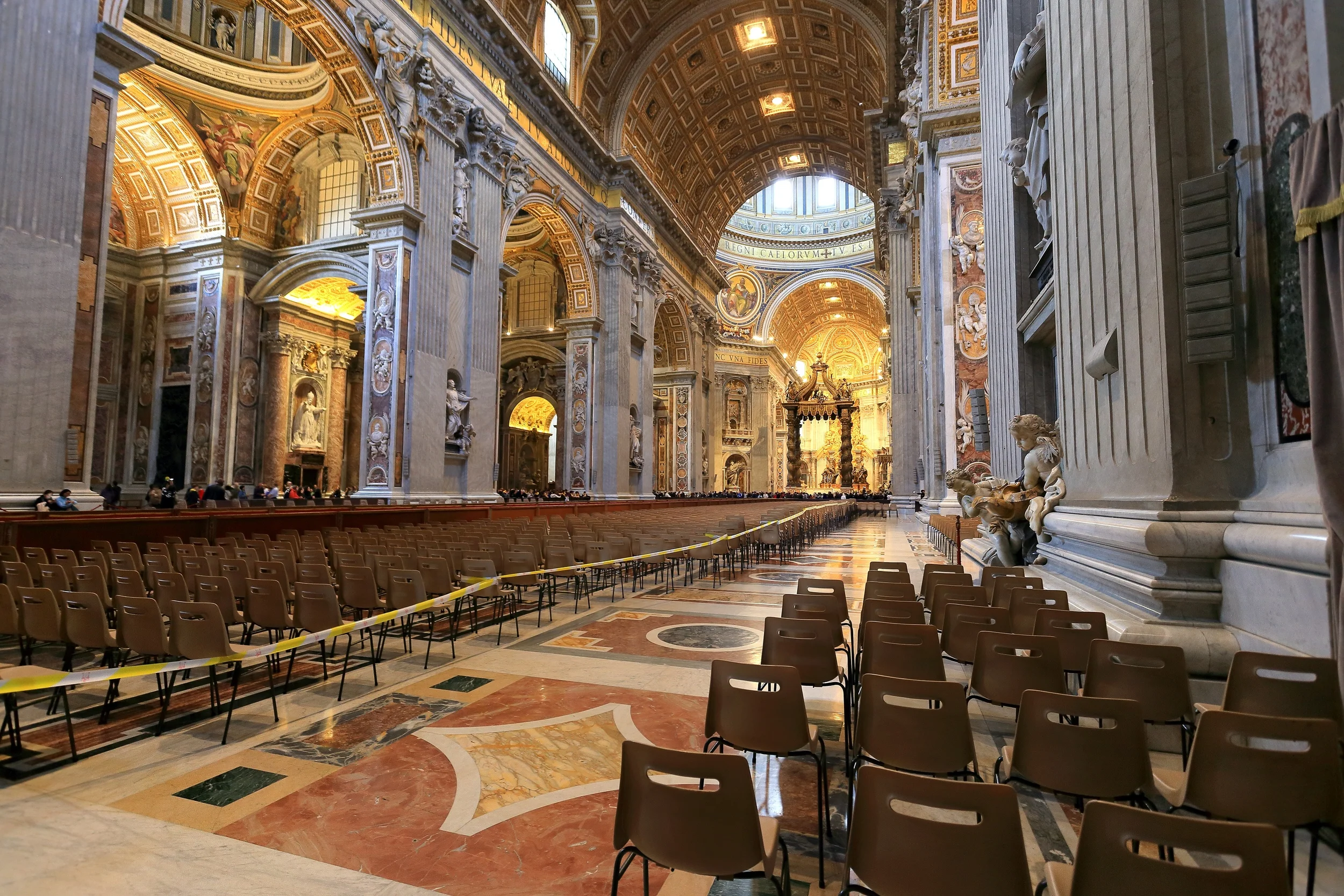


.jpg)
.jpg)